Friday, December 20, 2019

Historic Highways: Old Alignment Routes and Why They're Needed

The popularity of Old Route 66 highlights that public interest exists in memorializing and identifying old alignments of major highways.  While U.S. 66 itself has been decommissioned for over 30 years, various state agencies, local agencies, and historic preservation committees have come together to post signs identifying the old alignments and marking the routing so that tourists can not only find the route, but even older alignments that were used at different points.  Unfortunately, this recognition of old routes with special route signage is unusual in much of the country, and it is not consistent in design making it more of a curiosity than an actual useful means of marking these former routes.  U.S. 66 gets special attention over other U.S. routes, but many other just as significant old highway alignments remain left behind.  In fact, a portion of Old U.S. 66 in California was recently signed as San Bernandino County Route 66, but shouldn't this have been signed as something that actually referenced its former function?  Why not actually signing it as OLD U.S. 66 with an "OLD" banner and U.S. route sign?  In some cases, the local government responsible might even act like the highway was never moved and still refer to the road as "HWY XX" on street name signs, adding to the confusion.  Quite a few old alignments still serve as highways, and they should be signed with appropriate highway signs that can be followed in a similar fashion.  Those driving these old routes would likely prefer to see them signed closer to how they remember it than one of the many styles like the one shown below.


Non-traditional signage for Old U.S. 66 in Kansas (Image from Google Street View)

As to most old alignments, it is often difficult to follow them.  This is because in most cases the state government has abandoned them, and signage is inconsistent or non-existent for these routes.  It does not matter that they are no longer the route: these roads had a long history carrying a particular highway number attracting businesses and even culture with it.  They still serve as an alternate route, and their recognition is beneficial to the communities that are located along these roads.  Shouldn't they be recognized in some way that not only helps preserve their history, but also helps in navigational purposes? 

It is interesting to note how many former highways are referred to by locals as "Old Highway/Route (number)" across the country.  Most of these roads identified as "OLD" routes are typically roads that were previously major highways that were by-passed years ago by wider roads, straighter roads, or faster roads (interstates, Appalachian Developmental Corridors, etc.).  Many of these "OLD" routes are very scenic compared to their modern equivalent.  Even if it has been 50 years since they were last a highway, the novelty of these old routes remains enshrined on street name signs along with a few reminders of its past such as an older style of guardrail, historic bridges in some areas, and in many cases older structures such as 1940's filling stations, early 20th century housing stock, old motels, old billboards, abandoned schools, quaint downtowns over 100 years old, and many other odd points of interest.  Relic road signage may also be left behind as well such as obsolete mileage signs.


The need for "OLD" route signage is on display here with this vulgar attempt by Roscommon County, Michigan.  (Image from Google Street View)


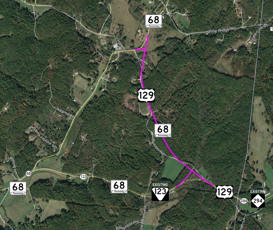
Another instance in Randolph County, AL, where an old route of US 431 is signed with a county route pentagon as "OLD 431".  (Image from Google Street View)


Unfortunately, it is also often these roads received a name that hides the former designation, but locals still refer to these roads as such creating confusion.  Picture roads called "Dayton Pike" or "Hilltop Road", which in both cases are actually Old U.S. 27.  The common thread, however, is that these old state and U.S. highways were often major arterial highways that were replaced by another route at some point.  While many old alignments are too short, too local, or too primitive to sign for navigational purposes, many more are not.  Usually, these are longer stretches ranging from 5-30 miles that parallel the newer highway by a longer distance.

Old alignments do not always refer to directly parallel routes.  It could also be a highway that was decommissioned with no nearby replacement, or it is a piece of older highway running through a community built up to the point that it was by-passed.  Often, other state highways that have to use part of the old alignment to connect to the current route use portions of the old alignments, but they do not always affect the connectivity of the old route since these are often lower volume farm-to-market routes that do not get any intersection adjustments.

The important thing to remember about an old alignment is that most of these roads are maintained by local governments and are either completely unsigned as a route or carry a wide variety of ambiguous local route numbers.  While parts are at times signed with a different state route number, a "BUSINESS" banner, or more rarely "ALT", the usual destiny for a highway left behind is a changeover to an unnumbered road with lower levels of maintenance than when it was previously a highly traveled road maintained by the state.  Signing "OLD" routes refers to these sections of old U.S. or major state route that are not numbered or in some cases signed as a county or secondary state route often with a generic number unrelated to the former highway usage such as KY 3001 for a part of Old U.S. 421 or CR 30A for Old U.S. 98 in Florida.  These numbers, if posted, are useless for those seeking to explore an old alignment of a highway, and they may not be recognized unless the motorist studied the maps beforehand or are able to identify some clue exists of its former usage such as abandoned pavement where a piece of road was closed when the old alignment was moved to connect to the new route.

OLD ALIGNMENTS AS STATE ROUTES

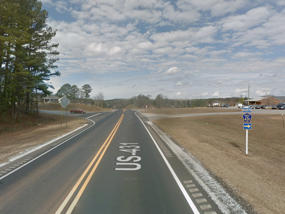
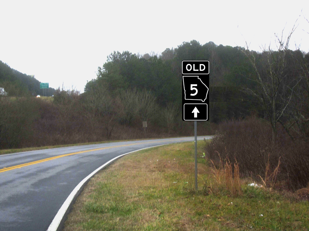
Old alignment signs can be used for either U.S. or state routes.  It is important to consider that U.S. routes do not exactly line up with arterials.  In fact, many National Highway System routes are assigned only as state routes, and some are even local roads.  Since many state routes are also major highways, posting old alignments with OLD route assemblies is perfectly sensible.  Often, these routes are still regularly known as "OLD HWY/RT. XX".  Examples include Old NC 49 near Asheboro, NC and Old GA 5 near Ellijay, GA.


Old GA 5 (the local name for the road) near Ellijay, GA has these plaques installed.  It was replaced with the road visible on the left in the 1980's.  Wouldn't it be more beneficial to actually identify the route with a proper route sign?  The meaning is the same, but the signage is better.  The re-design below shows a one-piece assembly on a 24" x 54" blank, but that is not required.

OLD ALIGNMENTS WITH NO REPLACEMENT

Some old alignment routes are not relocations, but simply the revocation of a former route.  While many of these are forgotten to time, this is not always the case.  Some former routes that are not major highways still get referred to by their old number: possibly due to the fact that the original route was very long.  It may be good in some rare cases to at least partially reference one of these old state routes that are unrelated to the current route if the public still recognizes the highway by its former route designation.  Examples of this include Old NC 105 and Old GA 108: both mountainous routes that were revoked with no nearby replacement although they both connect to or fall near to the current routing.  In most cases, this reference is only needed if there is no other county route signing program.  In the states that do, these former routes often tend to preserve the former route designation such as is the case in Florida or New York or they reassign the route to fit in with a special system of county highways (such as Wisconsin or New Jersey).  Since maps often still recognize these routes by their former number, a visual reference to the former routing would be very beneficial even if the road has not been owned by a state government in 30-40 years.  Unlike other former routes, though, signage may be limited to a text reference under the road name on W16-8 signs at junctions followed by a reassurance assembly with an actual "OLD" assembly with a special plaque underneath like "LOCAL MAINTENANCE" to indicate that it is no longer an active route, but this was its former route number.  Obviously, in most of these cases assigning an appropriate county route number might be beneficial over posting an "OLD" route, but in the many states county route signs are not used a visual reminder of its former life as a state route would be useful information: especially when many maps and directions still reference the former route number.


The image above shows how a reference marker works for low-importance "OLD" routes.  The former route sign with an "OLD" banner and a reference to the fact that it is owned by a county or municipality is posted where it junctions with an active state-owned (or primary state) route.  No other route signage is posted except these reference markers.


Along with the reference markers, intersection warning signage along the active routes should include a W16-8 sign that includes both the name of the road and the former state route designation listed below it.  Note that this signage is only used if the road is not otherwise signed as a county or secondary state route.

NEW SIGNAGE FOR OLD ROUTES

The problem with moving highways away from old alignments is that it leaves cities, towns, and communities behind.  While the change in traffic patterns is purposeful and unavoidable, creating a properly signed alternative when a highway is moved is preferable to dividing it up into different numbered and unnumbered routes.  It establishes a clear "scenic" or slower alternative where local businesses may still flourish: especially if the newer route is limited access.  A standard approach to signing old alignments should be adopted that involves using an "OLD" banner with the original route number sign posted in inverted colors.  The "OLD" banner and any other directional signage used should also be reversed so that the interstate banner designs are used except that black is used as the primary background color instead of blue.  The purpose of using black is not only to give the signs an "antique" appearance but also to make the signs readable, yet less noticeable or important than other routes at night.  If an "OLD" route is displayed with other route signs, it will stand out in the way that it provides the information while not getting confused with other active routes on display.


Note here how the contrasting colors are designed to alleviate confusion between the old route and the active route.  At night, the sign on the right will stand out more than the sign on the left.  In the day, the information displayed indicates two classes of roads even though both roads were historically the same route.  This road once had a state route number unrelated to its former history, and this designation would be far more beneficial for people looking to explore history and find local businesses along the old route since it is readily recognizable as such. (Image from Google Street View)

In states that use colored shields for state routes, state route signs in this case would be changed to black and white and/or an older state route design used.  The purpose of this is to sign the route without confusing the public into thinking it is a current route.  The design described gives an "antique" appearance, differentiates it from other routes, other signs, and it provides lower visibility at night so as to allow any other signs posted in conjunction with the "OLD" assembly to stand out.  Reversing the colors also allows the original route symbol (U.S./state) to be used while differentiating it from other U.S. and state routes.


In Tennessee, prior to 1986, all state routes were indicated with an inverted triangle.  Most old alignments were relocated prior to this changeover where major routes were given a different sign, so old alignment routes in Tennessee would be best suited to use inverted colors on what is now the state secondary route sign.  TN 42 was changed to TN 111 in the past 20 years, but the route includes lengthy old alignments that are still classified as collectors and still identified as "OLD HWY 42".  Using this sign would make the most sense, especially since functional classification is used to divided primary and secondary, and these roads would be secondary if still state controlled.


SIGNAGE IS AN IDENTIFIER, NOT AN OFFICIAL ROUTE

It is important to note that "OLD" routes are not actually routes at all.  They neither indicate maintenance nor ownership, and they are used to indicate a former alignment of an existing route, not an entirely separate route.  Instead, they identify with signage where a route USED to go.  In fact, "OLD" routes may follow part of existing routes for other highways meaning that fully signing them may cause confusion.  In addition, an "OLD" route fully signed may be problematic when coupled with existing "BUSINESS" routes.  For this reason, signage should be used sparingly in locations where signage along existing routes may cause confusion.  This is where trailblazer ("TO") signage would be best at the point where a business route overtakes the old route.  Signage for "OLD" routes would follow the following rules:

  1. It would not be signed along functionally local old alignments unless the old alignment passes through an incorporated town or clearly established unincorporated community (includes structures like post offices, schools, churches, businesses, etc.)
  2. It would be signed at junctions with state routes, former state routes, and federal-aid eligible roadways if the roadway is otherwise unsigned
    • If the roadway is signed or otherwise part of a state route, signs should generally not be posted at junctions
    • If the roadway is otherwise signed as a county or state number for a section of the old route, the "OLD" route signage should superimpose it and replace it so that, say, County Route 742 used for Old U.S. 46 would be signed instead as "OLD U.S. 46".
  3. Signage at junctions would not include a "JCT" (M2-1) sign (since it is not an actual route), but directional arrows should be used liberally to indicate approaching "OLD" routes or changes in alignment at intersections.
    • Remember that this signage is a substitution for textual guide signs where "JCT" signs are not typically used
  4. Directional banners (M3-1 through M3-4) should not be used unless the road is actually established as an official route or it is already known locally as "OLD HWY/ROUTE XX".
  5. All old alignment routes must include an "OLD" banner on top with white legend on black background.  It should be a separate banner and NOT part of the route shield itself.
  6. All route signs used should be white on black giving the appearance of inverted colors.
    • The inversion of colors makes the "OLD" sign contrast from other route signs
    • It also gives the appearance of antiquity appropriate for an old alignment
  7. When overlapped with other routes, it should include "TO" signs past the junction either to the next independent section of old alignment or to the current alignment of the route.
    • In one instance, Old U.S. 43 is broken by a section of State Route 12 where signs would be posted at each junction as "TO OLD U.S. 43".
    • In another instance, the old alignment of Old U.S. 31 is completely covered on the north end by a section of State Route 54 where signs would be posted from the junction as "TO U.S. 31" and a trailblazer for "TO OLD U.S. 31" would be posted where State Route 54 meets U.S. 31 from southbound U.S. 31.
  8. Signage would not be random for these routes.  They would be assigned based on eligibility and posted only after a review process through the state government although signage may be posted at key locations without a decree.

Despite these conditions above, there are cases where signing an "OLD" route as a route may be perfectly acceptable with junction signs and directional signs.  Inversely, there are cases where an OLD alignment may be technically eligible, but posting it would cause far too much confusion and should not be posted at all such as through a dense urban area or downtown area: especially if the original roadway is carved up in such a way that it does not properly connect.  It really should be handled on a case-by-case basis with an agreement made by all stakeholders involve: the state, local government, and any private stakeholders that privately finance signage.  The important thing is that signing an old route is supposed to AID motorists to or from a well-located and well-traveled older route.  If it causes too much confusion or is not suitable for through traffic, it probably should not be signed.  

WHERE "OLD" ROUTES MAY NOT BE SIGNED WHERE THEY ARE OTHERWISE ARE POSTED

Since OLD routes would not usually be official routes, two places where it should not appear are on official state highway maps and freeway guide signs.  In the latter case, the old route signage would be best appearing as text on a separate sign, and on state maps it should not be shown as a route shield.  If used on freeway guide signs, the state or US shape will need an additional white outline so as to prevent the sign from appearing washed out.

ELIGIBILITY FOR "OLD" ROUTES

If every state and U.S. highway that ever existed in a state were signed, things could get very confusing in a hurry.  This means that a selection process must be limited based on a set of reasonable criteria:

  1. The old alignment route usually should be signed only if it was previously designated an arterial and/or federal-aid primary route before the route was moved to another route.
    • Note that this refers to continuous signage with directional arrows, not reference markers indicating the beginning of a lower importance old alignment.
    • Exceptions should be granted if the former state route designation on a less important road is still recognized as such (e.g. the road is named OLD HWY XX)
  2. An old alignment of an old alignment cannot be posted with route signs (e.g. OLD, OLD), but text-based signs may be used with dates.  
  3. The roadway must currently be eligible for federal-aid (rural major collector/arterial) OR serve as a local business loop through a town or defined unincorporated community (see previous rule #1 for signage)
  4. Priority is given to former U.S. routes, although some major state routes should certainly be considered if they functioned in the same manner as U.S. routes.
  5. The old alignment was not substantially relocated after it was transferred to a local jurisdiction.
The last point is a pretty special case, and it doesn't happen often.  This is where the old alignment remains an important enough road that local authorities manage to substantially relocate the road away from its original course.  At this point, it is no longer an "OLD" route, but it is an entirely different road with no historical connection.  It is most likely to happen in urban areas where development requires moving the road and changing connections to the point that the authentic former route is over 50% lost.  A case-by-case basis will be needed to determine if using "OLD" signage on such a road would still be applicable.

WHO INSTALLS/MAINTAINS "OLD" ROUTES

The signage of "OLD" routes is bound to be a very low priority for local governments unless they already have an established route signing program.  While it is something that local governments COULD do, it is not a standardized practice at present.  In fact, some instances of old alignment signage do exist on a local level, but these tend to be more aimed at a historic aesthetic that is neither accurate nor does it actually function in any way to guide traffic.  In most cases, it involves posting a county route sign with the same route number such as County 61 in Minnesota along portions of Old U.S. 61 or the previous example of "Old U.S. 27" placed garishly in a county route pentagon in Michigan.  Instances like this prove that signing old alignment highways like they're still a highway is desirable even if they are not official bannered routes.


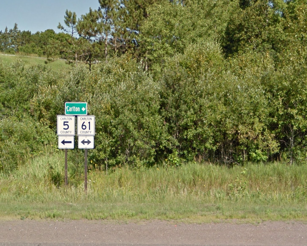
In Carlton County, MN, the former route of U.S. 61 (fully decommissioned) is signed as County Route 61.  Seeing that this is misleading for what was once a major highway, it is obvious how much better the signage below is when identifying the road as OLD U.S. 61.  Even better is that the Minnesota sign manual actually does have a standard plaque for OLD routes, and this is designed according to that manual.  It could still be labeled on the state map as County Road 61.  Obviously, this example also displays the typical deficiencies in locally-installed signage.

The best approach is to first develop a statewide or national standard for the signage.  Currently, the MUTCD does not disallow, but also does not allow official signage to carry any colors other than the standard black legend on white background.  States have found out the hard way, who attempted color-coded U.S. route signage in decades past, that at the very least it is a sure way to lose federal-aid money for signs and that they will have to replace each sign at their own expense if it does not meet those requirements.  If it is not encoded as a federal standard, then it should be adopted as a state standard with the prescribed design.  In some cases, states may also wish to use an older style that incorporates cutout shields, sometimes with the state name, that was used up until the early 70's.  If that style is used, it should still match modern dimensions (24" x 24" for 1-2 digits/30" x 24" for three digits) with a design based on the current California U.S. route design.  However, it should also have inverted colors so that the legend is white and the background is black.  Note that brown is sometimes used for BUSINESS, "SCENIC", and ALTERNATE routes, but brown is not recommended for OLD routes.  The brown color could be mistaken as any one of those or as an official route.

Funding for old route signage should be either public or private.  Interested groups that might want to finance old route signage should be allowed to do so as long as it meets state standards.  Otherwise, the states should finance the installation of these signs regardless of jurisdiction with maintenance by the local governments only if they can sign an affidavit indicating that they will maintain signage to those standards or lose funding/be required to remove signage.  Generally, the state should furnish these signs for the local governments, but if the local governments are responsible, they should either be required to purchase from suitable vendors or have the state provide a plottable file layout if the local agency makes its own sign.  Sign should also be on at least a 10-15 year replacement schedule.  It is not an all-inclusive program.  It should be incrementally installed during intersection improvements, guide sign projects, federal-aid safety projects, and on a case-by-case basis.  Preferably, the creation of a state-managed or federal guide sign program should be created that includes these as part of that program, and this would work much better if the installation and maintenance of these is centralized as much as possible.

"OLD" signage may also be applied to active state routes, if desired.  It can be used when an old alignment of a highway might otherwise be an unsigned route or secondary route.  It may also be used in place of the existing state route number, but it should NOT be superimposed onto an existing highway that is not designated just for that old alignment.  In other words, if SR 556 is assigned exclusively to part of Old US 40, then it can be signed as OLD U.S. 40, but if it turns off and only follows part of the route, then it would need to have both routes signed.  In this case, the "OLD" route would be both signed and maintained by the state.  In fact, "OLD" routes are designated regardless of jurisdiction as long as they do not affect the connectivity of any other routes that follow portions of that old alignment or cause confusion.

COLORS IN U.S. ROUTE SIGNS: HOW OLD ALIGNMENT SIGNS RELATE

This plan also presents a need to relax the rules of color-coding U.S. routes, but with some specific criteria.  Obviously, orange and yellow U.S. route signs like Florida once used are probably a bad idea, but that does not mean that color-coding is a bad idea.  At one point, several states used color-coding for U.S. highways before it was forbidden when Florida was forced to revert to standard colors in the 1980's.  Color-coding could also be found in D.C, Mississippi, Arizona, and possibly other states up until the 1970's.  While a rainbow of colors is not exactly a good idea, the requirements for white on green with street name signs were relaxed themselves meaning that this strict policy of black-on-white signage is neither realistically enforceable nor necessary.  This should also be the case with U.S. routes with the following color variants permitted with a recommended use for each:


  1. Black on white (Regular U.S. route)
  2. White on black (Former U.S. route)
    • Used for old alignments of U.S. routes only
  3. Blue on white/white on blue
    • Special U.S. route corridor such as Appalachian Developmental
    • Should generally only be used on expressway-grade highways in consideration for eventual development into an interstate highway
  4. Brown on white/white on brown (Historic Route)
    • May only be used for an official BUSINESS or ALTERNATE route
    • May be used in lieu of white on black for old routes ONLY if color variation is used for old alignment routes and not BUSINESS or ALTERNATE routes
  5. Green on white/white on green (Scenic Route, BUSINESS or ALTERNATE route
    • May be an unofficial route, but must be a state maintained road
    • Already used in Maryland and some parts of Georgia for BUSINESS routes
  6. Purple on white/white on purple (Toll Road)
    • Toll road signage tends to be purple, so this would add to the conspicuousness of the signage as a toll road
    • Few U.S. routes contain tolled portions

JUSTIFICATION FOR SIGNING OLD ROUTES

This blog has made quite clear that the drilling down of road responsibility of roadway signage to so many small local entities has been disastrous for roadway standards, and it has made thousands of miles of roads inaccessible to qualified traffic engineers who could help set policy, plan routes, streamline costs, and introduce concepts to improve navigation such as signing "OLD" routes.  This means that a program like this really should not be done randomly.  It should be introduced as a state or regional program with dedicated funding, clearly written standards, and routes planned accordingly.  States who follow these guidelines should also make sure that signs are both maintained and maintained correctly meaning that a traditional home rule approach to signage must be suspended for this to work.  While they are not officially routes, in many cases the "OLD" routes would be used as signage in place of generic county or state route designations.  

While this concept provides a means of preserving history, it also creates an economic benefit by properly identifying by-passed sections of major highways not otherwise eligible for "BUSINESS" or "ALT" designations in hopes of attracting tourism and supporting local businesses along the old highway alignments.  Additionally, it creates the added benefit of clearing up confusion about where old alignments are: especially when the road name or route number is different from "OLD HIGHWAY XX".  It is not a particular costly strategy considering that these signs can be added to existing assemblies at state junctions, and the signage is often more limited (no "JCT" (M2-1) or directional banners (EAST, etc.) posted along most of these routes.  There are also not many roads that would need this vs. a county farm-to-market route program meaning that it does not involve the assigning of far more routes on unnumbered roads: perfect for states that do not post route signs on local roads and streets. 

While other priorities do need to be considered to improve signage on state and local roads across the country, incorporating this plan will be widely beneficial to the public.  In addition, perhaps a successful strategy of cooperation in installing and maintaining "OLD" route signs along with any needed guide or other signs might demonstrate to state and local agencies that an overall cooperative strategy might be best.  Assigning old alignments is likely to be met with broad public approval: both for the historic novelty and the assistance in navigation.  

Wednesday, January 10, 2018

A Dangerous Route in Need of An Alternative: US 129 from Ranger, NC to Maryville, TN

U.S. 129 has reached mythical status for mulleted middle-aged men in Harley's and younger guys in sports bikes shooting the 318 hairpin turns between Robbinsville, NC and Knoxville, TN, but it is a very poor location for a U.S. highway.  A quick Google search, in fact, does not even remotely recommend that U.S. 129 traffic even use that way at all to reach Maryville, TN en route to Knoxville from where it joins U.S. 64 in Ranger, NC.  Nonetheless, the highway that is popularly known as "The Tail of the Dragon" became enough of an issue that a proposal surfaced in the early 2000's to tear it all up for an interstate, I-3.  The interstate proposal was so unpopular that it basically got canceled, but that does not mean a better route is needed: just not there.


Seemingly endless hairpin curves in steep terrain greet drivers of U.S. 129 between Tapoco, NC and Chilhowee Lake in Tennessee.  While it provides unparalleled thrills for motorcycles, it is not such a thrill for through traffic.  Trucks are advised against using this route, and it is mostly useless as a through route for all but tourists and residents of Graham County, NC.  Note here in this image that the road is starting to slip toward Calderwood Lake.  The terrain here drops around 300'-400' on the right.  Photo from Google Street View.

The funny thing is, this is not truly a fixable highway.  It is located in very steep terrain with unstable and sulfuric Anakeesta rock.  It is also a dangerous passage along deceptively deep reservoirs holding back the Little Tennessee River, and it wiggles around very high mountains.  The damage building a modern four-lane road through there would cause would be incalculable.  This includes frequent landslides due to the massive cut and fill that would be required and the risk of poisoning a significant water source from the leeching of sulfuric compounds from the Anakeesta Rock.  In addition, hardly anybody wants any more interstates book-ending the Smokies: even the two-lane park road planned along Lake Fontana (Lake Shore Drive) was finally canceled a decade ago that was designed to replace a long-abandoned state highway (NC 288).  Google's simple map logarithm proves that this road should not even be U.S. 129 at all.  Politics yet again favored an unsuitable mountain crossing elevating a torturous mountain back road into a lengthy section of a major U.S. highway with a long and pointless overlap through Cherokee County, NC.  Lessons should have been learned from the costly disaster that I-40 was when it was slammed through Pigeon River Gorge, but the fix for this road is perfectly clear.


What Google thinks is that U.S. 129 is not the best way to Knoxville.  Even with the less than desirable conditions on TN 68, it is still a better and safer road than U.S. 129.  This is why perhaps U.S. 129 should be moved to the blue highlighted route shown.

Looking at this, it is obvious something needs to be done to change this: U.S. 129 needs to be moved.  For novelty purposes, keeping an alternate route of U.S. 129 along the existing road is an acceptable option.  Re-designating the entire route as U.S. 129 Alt from it current junction with U.S. 64/74 in Ranger, NC to its junction with U.S. 411 near Maryville is certainly an acceptable approach, and it keeps the U.S. 129 designation without marketing it to travelers as a major route.  Relegating it to a state highway is also an option.  While Tennessee can easily do this by revealing hidden TN 115, it is not so clear what to assign it in North Carolina since the original route number 108 as well as 115 are both accounted for elsewhere.  It is also bound to be unpopular due to the tourism that U.S. 129 on its current route attracts.  Perhaps the numbers should be switched so that NC 294 is reassigned to existing U.S. 129 north of U.S. 19/74 and Tennessee likewise renumbers TN 294 in Livingston to assign it instead to existing U.S. 129 so that it is all Highway 294 from U.S. 411 to U.S. 19/74.  I guess a public hearing should be conducted where they get to choose between NC/TN 294 and U.S. 129 Alt.

As to where the new U.S. 129 should go, the logical route is painfully obvious, and it is clearly marked in the map in light blue above.  This new route would be divided into the following segments:

  1. Overlap with U.S. 64/74 west from Ranger, NC to NC 294
  2. All of NC 294 from U.S. 64/74 to the Tennessee State Line
    • NC 294 would be decommissioned along its current route
    • The number 294 would be available to assign to swap with existing U.S. 129 north of U.S. 19/74 to the Tennessee State line
  3. Continuation of U.S. 129 onto TN 123 with 123 relegated to secret status from the state line to TN 68
    • A relocation of the junction of TN 68 and TN 123 is highly advised and is described further shortly
  4. The new route then turns onto and follows TN 68 from TN 123 to U.S. 411 (TN 33) in Madisonville
  5. U.S. 129 then overlaps U.S. 411 from TN 68 in Madisonville to the current junction of U.S. 129 (TN 115) southwest of Maryville.

GREATER NEEDS FOR TN 68 AND A RELOCATED US 129

TN 68 and NC 294 share a significant problem: while some spot upgrades have occurred over the years to streamline the hairpin turns caused by the ruggedness of the terrain, these are both steep and winding mountain roads through remote areas.  It won't be as simple as slapping a U.S. 129 shield on the new route: some improvements will have to be made.  One of those that is glaring is the junction of TN 68 and TN 123 with a peculiar movement favoring TN 123.  This movement requires TN 68 traffic at present to make a diagonal left turn, and if U.S. 129 was routed in from the opposite direction, it would force traffic to make a sharp right (or left southbound) to continue on what would be U.S. 129.  In fact, a closer look at Google has projected U.S. 129 traffic directed onto county-maintained Runion Road: a narrow, winding road that will need to be realigned and upgraded to highway standards to better align TN 68 to TN 123 just west of the state line.  A quick look at Runion Road reveals a paved cowpath that will have to be substantially rebuilt meaning that the reworking will take awhile.  This will drastically change the highways through the Turtletown community, if built.


The sharp switchback required to go from NC 294 to TN 68 north has resulted in Google routing through traffic onto an unsuitable county road known as Runion Road.  For U.S. 129 to go this way, Runion Road will need to be reconstructed and intersections realigned for it to work.


Here, Runion Road is straightened out with intersections realigned to make the new U.S. 129 the primary movement.  Because of this, it might make sense to also move TN 68 onto existing TN 123 to meet at the junction with current Runion Road.  While distance-wise it makes sense (and I would personally prefer it) to have TN 68 remain intact on the upper left, the reality is that the through movement is TN 123 and that it makes more sense to turn that section into a county road or short secondary route.  On the other hand, most of TN 123 would be decommissioned with exception to an unsigned portion between the relocated TN 68 and the state line.

The unfortunate thing about TN 68 is that somehow this highway has been ignored for substantial upgrades and is actually worthy of a study for a major relocation itself.  It is an incredibly scenic drive, and a side of me does not want to see it changed, but the fact is that this is the most suitable route to provide an inter-mountain connection compared to many other alternatives.  In fact, a realistic long-term prospect is to relocate I-75 onto this corridor through an interstate-grade road forking off of the current I-75 near Knoxville and following existing TN 68 south to meet the current U.S. 76/GA 515 west of Blue Ridge.  The existing GA 515 would then over a period of many years have intersections removed, interchanges constructed, and be upgraded to interstate standards including a new eastern by-pass of Ellijay and a shifting of the highway to create frontage roads so that the existing highway can become fully limited-access up until where the road is currently I-575.  I-575 would then revert into part of the new I-75.


The current route of I-75 steers traffic west/northwest.  While it has served its purpose well for many decades, it is increasingly congested and without a viable alternative.


Currently, the proposed route offers no time savings, and is only slightly shorter, but this is considering that on the Tennessee side, the road needs significant straightening and realignment.  That could cut as much as 15-20 miles off of the distance and provide a viable alternative if the Georgia side is upgraded to full freeway.  

In the short term, however, efforts should be made to straighten out the worst of the kinks.  While improvements for NC 294 are not as dire since significant investment has gone into upgrading the road, TN 68 is a different story.  Itself, TN 68 is 50 miles of hairpin turns between TN 123 (the Tennessee extension of NC 294) and the Tellico Valley (junction of TN 165 in Tellico Plains).  Large sections of road will either need to have the curves smoothed or the entire highway relocated to a better alignment.  In fact, the current condition of the road proves to be a major barrier between the Copper Basin (Copperhill) and Tennessee Valley.  On one hand, whatever improvements are made should be incorporated into a design that can be eventually upgraded to an interstate highway (super 2 or two lane on 4 lane right-of-way).  On the other hand, improvements should be minimal enough so that the existing road can remain in service as an alternate route when an interstate replacement is one day built.


Areas like the Hiwassee River crossing show that significant straightening of the road would greatly shorten the distance and increase the speed of the route.  On the right is a series of hairpin turns and switchbacks along the existing TN 68.  The proposed potential route on the left involve hill cuts and a high bridge over the Hiwassee River to straighten out this serpentine section.  Even if it not built to interstate standards or ever considered for a true APD corridor, simply relocating and straightening out the route as a two lane highway with passing lanes would greatly improve access to the area.  

A NEW APPALACHIAN DEVELOPMENTAL CORRIDOR

In order to finance construction of a new highway along TN 68 and GA 5 from Blue Ridge, GA to Madisonville, TN it is going to need a significant federal investment.  As it presently stands, funding for this corridor has been sparse at best.  It took 35 years just to even get the Copperhill/McCaysville By-Pass funded, and the project was scaled down from a four lane to a two lane!  Obviously, moving U.S. 129 will highlight the importance of the corridor further north, but initial improvements will mainly be to improve safety and connectivity.  Nonetheless, the delays in upgrading TN 68 pale in comparison to the delays in completing Corridor K, a very emotionally charged project that will likely only be built if public input is pretty much made non-existent.  Perhaps instead, funding can be steered to a corridor less emotionally charged and less scenic.  Corridor K travels through some of the most pristine country in the east as it traverses two deep gorges: Nantahala and Ocoee.  Ocoee Gorge is a significant treasure that people fear will be destroyed by construction of a new highway, but at present there is no suitable alternative.  Since GA 2 was canceled in the 1970's, and no other east-west links exist in the area, perhaps a high speed roadway running from the Georgia State Line to I-75 near Sweetwater would help alleviate some of these issues.  Think of how I-26 took pressure off of I-40 even though it goes in a more northerly direction and further east.  It is the same case with TN 68.


While not part of the U.S. 129 change, upgrades to TN 68 would overall be a very challenging project.  The area of Harbuck in particular is a squeeze point where either extensive cut and fill and disruption will be required in the Harbuck community or two tunnels will need to be constructed under Stansbury Mountain.  This is part of why building the road initially with only one carriageway (super 2) might be beneficial.  A tunnel would be half the cost if it's three lanes wide vs. two three lane wide tunnels.  Ideally, most of current TN 68 is kept intact as an alternate route if a new highway is constructed and kept on-system as a secondary state route.

Even if nothing like an interstate grade road is ever built, it would be a good idea to at least design an improved TN 68 that has the potential to become that.  Design it with right-of-way for a six lane highway with limited access on entirely new location with land set aside for future interchanges would be a start.  Considering that a potential of as much as three tunnels are needed, and significant cut-and-grade is needed, it is not a cheap project.  A significant investment was already made to rebuild TN 68 north of Tellico Plains, and this would simply be a continuation of that project giving a faster, more direct link between Tennessee's most geographically remote cities of Ducktown and Copperhill and the rest of Tennessee while providing a broader alternative to Knoxville.

HOW TO START THIS PROJECT

The initial steps to get the ball rolling for a small change leading to a big change is to recognize right away that U.S. 129 on its current route is not an acceptable route.  The steps of change are as follows:

  1. Reconstruct Runion Road into a new route for TN 68 that will be oriented to allow NC 294 to seamlessly transition into TN 68.
    • This will result in a relocation of TN 68 onto part of TN 123, resulting in the elimination of TN 123 except as a small hidden overlap with U.S. 129
    • Primary movement will be current TN 123 (east) to Runion Road on the south and TN 68 (north) to Runion Road on the north
  2. When this road project (approximately 1 mile long) is completed, relocate U.S. 129 onto this new route according to the previously described routing.
  3. Existing U.S. 129 will become either U.S. 129 Alt or downgraded to state routes depending on what both states decide.
  4. Curve realignment and the construction of truck/passing lanes from Turtletown to Tellico Plains should be conducted where practical to improve safety and speeds along the portion where U.S. 129 and TN 68 are co-signed.
  5. Once this project is completed, begin studies to construct an interstate-grade highway from U.S. 64/74 near Ducktown to U.S. 411 in Madisonville
    • This will be the first phase of a replacement for TN 68 
    • This does not involve U.S. 129 as much as it does TN 68 meaning that it will be a project exclusively in Tennessee
    • It may be constructed as a(n)
      • interstate-grade road (full freeway)
      • surface four lane expressway with ROW for future overpasses/interchanges and additional lanes (bridges should be constructed for six lanes)
      • super 2 (full freeway on a 2-3 lane undivided roadway)
      • surface two lane with interchanges built out for future expansion of remaining roadway
    • All designs should accommodate for an interstate-grade road containing six lanes meaning the super 2 should consist of three lanes with continuosly alternating passing lanes.
  6. When this project is completed, extend an interstate-grade road from U.S. 411 in Madisonville to I-75
    • This should be constructed to full interstate standards following TN 68 and include a high speed interchange with I-75 between Sweetwater and Farragut
    • It should be constructed with six lanes
    • It should be designed in a manner that allows large portions of Old TN 68 to remain on system as a secondary state route to serve the local communities of Coker Creek, Ironsburg, Farner, Turtletown, and Harbuck as well as the cities of Tellico Plains and Ducktown
    • It should include a realignment of Joe Brown Highway to meet the new road
  7. Georgia should begin upgrading existing GA 5/515 between Nelson and Blue Ridge to interstate standards by removing at-grade crossings and constructing interchanges
    • This will require relocation of portions of the highway to new alignment around built-up sections: especially in Ellijay and Blue Ridge
    • Existing ROW may have to be shifted to convert an existing carriageway into frontage roads and to reconnect old alignments into those frontage roads between Ellijay and Blue Ridge such as what currently exists in Cherry Log and Whitepath
    • While this is underway, a study for an interstate-grade road should commence between Blue Ridge and the Tennessee State Line following GA 5
    • The upgrades should include a widening of the existing four lane roadway to six lanes and realignment of substandard grades and curves where possible
  8. Long-term, Tennessee should complete the upgrade of the relocated TN 68 to interstate standards between the Georgia State Line and U.S. 411 in Tellico Plains to full interstate standards.
    • When completed, a six-lane interstate will connect from the end of I-575 in Nelson to I-75 west of Knoxville
    • I-75 will be relocated to this route with existing I-75 reassigned as extensions of I-24 and I-81

ADVANTAGES AND DISADVANTAGES OF THIS PLAN

What will start out as a simple highway shuffle will over time turn into a long and expensive road project, but it is necessary to create a more direct route between Knoxville and Atlanta while subsequently placing U.S. 129 onto a route more suitable for through traffic.  The major disadvantage of this plan is that it will introduce traffic and development into a scenic and remote area, but this area also suffers from a high level of poverty and very poor access.  It will also cut through mountains destroying the "wild" feel of the area, but this is no different than many projects underway in parts of North Carolina, Virginia, and West Virginia.  The benefit will be is that it will take the focus off of the more pristine areas further east along the existing U.S. 129 allowing it to be conserved for tourism and natural beauty while the less beautiful TN 68 corridor will function as a better route through the mountains than the current route involving U.S. 23, 74 and I-26 from Atlanta that is not designed to handle major interstate traffic and is becoming a worsening choke point through Asheville.  It will also provide substantial economic benefits to East Tennessee that are currently not offered due to a lack of an adequate north-south link.  No other route is suitable.  Any other option is long and dangerous with sharp curves through high mountains.  It is not something that will be completed for many years.  It will likely take as much as 30 years to study and build, so for that reason it is a good idea to start small and start now.

Tuesday, October 27, 2015

U.S. 72 Extension and Relocation in Alabama, Georgia and South Carolina

One thing that is truly missing across Appalachia and the Piedmont regions of Alabama, Georgia and South Carolina is proper east-west connectivity.  This is especially true north of I-20.  In particular, many have expressed for years the total lack of an adequate route connecting Atlanta and Huntsville.  Only two choices exist: a congested surface route along US 431 from Anniston to Huntsville leaving I-20 or a northern route crossing the Cumberland Plateau along a collection of entirely poorly marked and inadequate highways.  Much of that traffic follows the northern route to avoid the congestion of the southern route.  While the construction of such a route is decades away, the bigger problem is that no clear route exists connecting the two cities.  However, Google Maps has laid that out for us, and this route is not lost on the truckers that already use it.  While currently inadequate for major traffic, it is still built to adequate standards to become a U.S. route: a plan that hopefully will also emphasize the need to invest more in the upgrades of this route as well as improving the horrible east-west connectivity across North Georgia.

In addition, an oddity exists extending from Athens, GA to Rock Hill, SC in that a tri-state highway exists that just happens to carry the route number of 72: a hint that perhaps planners envisioned an eastward extension of US 72 that never actually happened.  This is highlighted by the fact that the number does not change in two states and that Georgia in particular placed the route under high priority with substantial upgrades from Athens to the South Carolina border.  In between are several very major routes that inexplicably only carry state route numbers.  If this route does not justify an upgrade in status to U.S. highway, then what does?


U.S. 72 at present goes through Stevenson, AL connecting Chattanooga to Huntsville, but the real need present is to connect Huntsville to Atlanta.  A simple fix to this portion of U.S. 72, including the portion through Stevenson, can allow U.S. 72 to be relocated to a much longer route of much greater need through large portions of Georgia and South Carolina than the present route in use today.

The U.S. 72 extension is a practical plan that would be handled in four phases.  They are as follows:


  • The first relocates U.S. 72 in Northeast Alabama along several routes from Scottsboro to Adairsville in Georgia.
    • Existing U.S. 72 north of Scottsboro would then become an extension of another U.S. route that currently ends in a very random place: U.S. 74.  
  • The second extends U.S. 72 east from that terminus from Adairsville to Gainesville in Georgia transforming portions of GA 20 and almost all of GA 369 to a U.S. highway.
  • The third portion basically connects the route to GA 72 in Athens via an overlap with US 129.  It then changes GA 72 and SC 72 into US 72 extending the highway from Athens to I-77 in Rock Hill, SC.  
    • Due to GA's unusual rules with state overlaps of U.S. routes, GA 72 would become the unsigned state overlap equivalent (US 72/GA 72) thus creating the only instance where a U.S. and state overlap share the same number like it is in 46 other states.  
    • A portion of US 72 will need to be located on SC 121 meaning existing SC 72 into downtown Rock Hill will need to be reassigned as US 72 Spur.
  • The fourth portion would require new construction extending SC 72 to an eventual eastern terminus and reunion with US 74 in Monroe, NC.
    • This portion would likely be limited access and will require a new bridge over the Catawba River
    • It will most likely follow or parallel NC 75

The new U.S. 72 routing would follow the following routes:

PHASE 1: SCOTTSBORO, AL TO ADAIRSVILLE, GA

This route would follow the following state routes:
  • AL 35 from existing U.S. 72 in Scottsboro to AL 40
  • AL 40 from AL 35 to AL 117
  • AL 117 from AL 40 to the Georgia State Line
  • GA 48 from the Alabama State Line to U.S. 27 in Summerville
  • Overlap with U.S. 27 from Summerville to GA 140 in Armuchee
  • GA 140 from U.S. 27 in Armuchee to I-75 in Adairsville

Looking at Adairsville to Huntsville (I-75 to Huntsville), the proposed U.S. 72 route is chosen by Google despite curves, hills and slower speeds than the alternative through Chattanooga (Image from Google Maps).


However, what is MORE striking is that when the route is extended to Atlanta, this route is STILL preferred over all other alternatives.  This means that these lowly state routes are in actuality carrying U.S. highway traffic (Image from Google Maps).

PHASE 2: ADAIRSVILLE TO GAINESVILLE

This route would follow the following state routes:
  • I-75 from GA 140 in Adairsville to GA 20 in Cartersville
  • GA 20 from I-75 in Cartersville to GA 369 near Lathemtown
  • All of GA 369 from GA 20 near Lathemtown to I-985 in Gainesville 

The route from Adairsville to Gainesville is clearly defined by Google matching up with typical truck routes of today.  It avoids windy GA 140 east of Adairsville instead following a portion of I-75 to Cartersville then following existing GA 20 and 369 to Gainesville (Image from Google Maps).


PHASE 3: GAINESVILLE TO ROCK HILL, SC

While less important than the two western legs, the need for the route extension further east is still viable.  It presents a badly needed east-west link for traffic as an alternative to traveling through Athens and as a means for bringing economic opportunity to parts of Northeast Georgia overlooked due to the lack of decent east-west routes.  The eastern phase also presents a unique and coincidental situation.  By sheer coincidence, GA 72 east of Athens is not only a major route but maintains its designation into South Carolina until its terminus in the southern suburbs of Charlotte.  U.S. 72 would ultimately assume this route replacing most of GA/SC 72 from Elberton eastward.

The route east of Gainesville is not so clearly defined, and part of this is due to a vital missing link east of Gainesville.  The connection and realignment of two county routes in Hall County would most likely correct this issue, but this does not necessarily mean that this correction is the most viable route.  Google analysis shows that three possible options are viable.  These options are:

  1. Route U.S. 72 along existing U.S. 129 to Athens then along all of GA 72 east of Athens meaning a full U.S. 72/GA 72 overlap.
  2. Route U.S. 72 along GA 98 from Maysville to Comer then along GA 72 east of Comer
  3. Route U.S. 72 along parts of GA 51 and 17 from Gainesville to Elberton in conjunction with other shorter routes.

Option 1:

The first option utilizes only existing state routes.  It follows:

  • U.S. 129 from GA 369 in Gainesville to GA 10 Loop in Athens
  • GA 10 Loop from U.S. 129 to U.S. 29
  • U.S. 29 from GA 10 Loop to GA 72
  • All of GA 72 east of U.S. 29 creating the coincidental U.S. 72/GA 72 overlap
This route is obviously the most simple to execute, but it has a distinct disadvantage in that it does not allow traffic to avoid Athens.  This means that U.S. 72 traffic would be forced into congestion related to Athens instead of by-passing it along less traveled routes through smaller cities and towns.  It is the least preferred option for that reason, but it does effectively establish all of GA 72 as a U.S. route as well as linking existing GA 72 to other routes.  In this plan, GA 316 should become the state overlap of all of U.S. 72 to avoid confusion and because the route would still be "Highway 72".

Option 2:

This option is probably the most logical route giving a completely direct east-west link with the fewest turns.  However, it does require substantial upgrades and intersection realignments where it passes through Hall County.  It also will require a renumbering of the westernmost portion of GA 72 between Athens and Comer.  It follows:
  • Old Cornelia Highway from I-985 to Joe Chandler Road (part of Old U.S. 23)
  • Joe Chandler Road from Old Cornelia Highway to GA 52 
  • GA 52 from Joe Chandler Road to GA 98 in Maysville
  • GA 98 from GA 52 in Maysville to GA 72 in Comer
  • GA 72 from GA 98/22 in Comer to South Carolina State Line

The GA 98 routing gives the most direct east-west route from Gainesville to Elberton helping drivers find a suitable alternate to driving through more congested Athens.  It also helps better locate larger cities such as Commerce and the small Madison County seat of Danielsville.  However, it faces limitations from the need for costly upgrades along the portion between Gainesville and Gillsville since the route follows existing county roads (Image from Google Maps).

Note that this route cannot be added as-is.  Several significant changes would have to be made to make it work.  First would be major upgrades to Joe Chandler Road.  This would include intersection realignments at GA 52 and Old U.S. 23 to make Joe Chandler Road the primary movement, lane widening on Joe Chandler Road, an intersection improvement with East Hall Road and completion of an already programmed bridge replacement.  In addition, both county sections would also become an extension/relocation of GA 98.  Also, two routes would have to be renumbered to make this work.  The first is existing GA 98 north of GA 52, which is recommended for a reassigned GA 207 (out of use for 30 years).  The second is the renumbering of existing GA 72 west of where U.S. 72 joins the route in Comer.  The route can no longer carry the GA 72 number under this plan due to excess confusion.  However, several good candidates are available.  These include:
  • GA 316 eastward extension along part of GA 10 Loop and all of GA 72 including the portions overlap with U.S. 72
  • Re-designation of GA 350 along all of GA 72 including the portions overlapped with U.S. 72
  • Re-designate the existing parts of GA 72 not included in the new U.S. route as U.S. 72 Spur
  • Designate existing GA 72 south of the proposed route and part of U.S. 129 west of Athens as U.S. 72 Alt
  • Extension and relocation of GA 53 along GA 316 and part of GA 10 Loop to overlap all of GA 72 including the portions overlapped with U.S. 72.  Existing GA 53 south of GA 316 could be renumbered or transferred to local maintenance.
Option 3:

This option is the northernmost option and would offer likely the greatest benefit as an east-west alternate route.  However, the existing roadways were not designed to carry an east-west route and would thus require substantial reconfiguration to make work.  Most of this would be west of I-85.  This route includes:
  • Old Cornelia Highway from I-985 to Joe Chandler Road (part of Old U.S. 23)
  • Joe Chandler Road from Old Cornelia Highway to GA 52
  • GA 52 from Joe Chandler Road to GA 323 in Gillsville
  • GA 323 from GA 52 in Gillsville to GA 51
  • GA 51 from GA 323 to GA 145 in Franklin Springs
  • GA 145 from GA 51 to US 29/GA 8 in Franklin Springs
  • Overlap with US 29/GA 8 from GA 145 to GA 17 in Royston
  • GA 17 from US 29 to GA 72 in Elberton

The GA 51 routing is considered because at present it recommends routing traffic along a long overlap with I-85.  While this is an acceptable option, it provides no benefit for communities near the route and dumps addition traffic onto I-85 that is already congested.  However, the route shown here does not consider using county road such as Joe Chandler Road.  The map below shows the same route with the modifications including distance and time to show the advantage especially after upgrades are made (Image from Google Maps).


The second map shows the GA 51 routing removing the barriers presented with routing traffic along an existing county road.  However, the upgrades required west of I-85 are significant and costly compared to the second option that includes only upgrades to Joe Chandler Road (Image from Google Maps).

In addition to the corrections along Joe Chandler Road, significant intersection realignments would be necessary to make this new routing work effectively, handle truck traffic and save time in comparison with other routes.  These upgrades would include:
  • Reconfiguration of intersection at GA 52 and GA 323 in Gillsville to make GA 323 the primary movement and/or construct a traffic circle.  If a higher speed option is chosen, this would require a short by-pass on the NW corner of the two routes.
  • Reconfiguration of the intersection of GA 51 and GA 323 creating a new roadway on the SE corner of the intersection between the two routes.  The new roadway would close the existing GA 323 east of that point and would make GA 323 the primary movement requiring GA 51 traffic to turn off of the new road
  • Realignment of GA 51 intersection at Historic Homer Highway (Old U.S. 441) in Homer to make GA 51 the primary movement
  • Construction of a traffic circle at the junction of GA 51 and 145 in Franklin Springs
  • An improved roadway connection in Royston possibly including the state takeover of Cook Street or a new southwest bypass
  • The construction of a full diamond interchange at GA 17 and 72 in Elberton
PHASE 4: SOUTH CAROLINA EASTWARD: WHERE DOES IT GO?

From Elberton, the route would continue along GA 72 eastward to the South Carolina line.  In South Carolina, the following takes place
  • Route in South Carolina follows all of existing SC 72 until SC 121 in Rock Hill
  • From there, U.S. 72 overlays existing SC 121 from existing SC 72 to its eastern terminus at U.S. 21 with an overlap of U.S. 21 to end at I-77.
    • Existing SC 72 into downtown Rock Hill would become U.S. 72 Spur
  • An eventual eastern extension may one day be possible to end at U.S. 74 in Monroe, NC via a new roadway connecting NC 75 to SC 122
    • This new roadway should be preferably limited access, especially on the new portions
    • A southern route connecting U.S. 21 east of I-77 to NC 75 may also be considered


The map above shows where US 72 would end in Rock Hill (following SC 72 and 121) and the proposed eastward extension.  The northern route in magenta following SC 122 connects the road as a surface highway to NC 72.  The southern route forking off of US 21 would be a freeway or expressway on new alignment ending at an interchange with US 74 east of Monroe.  This new route would create a southern connector from fast-growing Rock Hill to US 74 east of Charlotte.

WHY IS THIS NEEDED?

Northern Georgia and Northern Alabama have been known for many years to have poor east-west connectivity and part of that is due to the lack of a single major route to prioritize upgrades along.  Travelers from Alabama to South Carolina north of Atlanta at present have not a single U.S. route other than mountainous U.S. 76 and rely on a confusing splicing of state routes.  In neither South Carolina nor Alabama have any corridors been developed along these routes with by-passes or four lane sections that are needed to better manage traffic leading to a lack of development along these corridors and dangerous traffic situations as large trucks are using inadequate roads.  This state routes have not been unified in any logical fashion, do not indicate badly needed turns, have not been upgraded in such a fashion to better manage long distance travel and receive weak funding priority due to their lowered status as regional state routes instead of major intrastate routes.  In addition, Georgia has also not added a single mainline U.S. route in over 50 years relying instead on state route "corridors" such as the 500 series GRIP corridors that do nothing but contribute to public confusion.  Fewer designations are needed, and major routes in the state should be part of the U.S. route system in the majority of cases with the GRIP designations dropped due to their needless overlaps of already present routes.  

In fact, the politics of GRIP corridors do not actually line up with route importance in this case.  While the Scottsboro to Adairsville route has the highest need, it has received low priority for improvements by both Alabama and Georgia who both effectively treat it as a regular surface state route.  For instance, GA 48 is shown as a minor arterial instead of major arterial and has received very low priority for upgrades.  In contrast, GA 72 from Athens to the South Carolina line is not only a GRIP corridor but shown as a major arterial.  Some portions are only classified major collector such as GA 369 in Forsyth and Cherokee Counties.  All portions of this route should be reclassified as major arterial along with a renumbering to U.S. 72.

WHAT ABOUT OLD US 72?

Most of U.S. 72 north of Scottsboro does not follow a logical east-west direction before becoming essentially an unnecessary overlap with U.S. 41 and U.S. 64 in Jasper east of I-24.  In Chattanooga, U.S. 72 unceremoniously enters city streets terminating at the exact western terminus of U.S. 76: two east-west U.S. routes ending into each other!  It's a logical fallacy that came as a result of extending routes without thought as to where they would terminate.  U.S. 76 itself is mostly overlapped with U.S. 41 west of Dalton making it extend miles beyond its logical western terminus, so U.S. 74 makes the most sense to replace it.  U.S. 74 at present ends at the junction of I-75 and I-24, but it is not signed past its interchange with I-75 near Cleveland.  By signing U.S. 74 and extending it westward along I-24, U.S. 74 can easily and cheaply replace U.S. 72 between I-24 in Jasper and AL 35 (proposed U.S. 72 relocation) in Scottsboro.  Better yet, extending U.S. 74 effectively ties two APD corridors together: Corridor K and Corridor V.  In no way is the importance of Corridor V diminished, and in fact U.S. 74 becomes effectively a longer route tying Huntsville to Cleveland, TN through Chattanooga.  This extension effectively eliminates at least two logical fallacies leaving only U.S. 76 to correct (which will likely come later since a new route is planned from Dalton to Trenton that could carry U.S. 76 on a better route).  It also better unites two corridors that function much like surface interstate highways.


Corridor K and Corridor V can be linked together in a logical fashion by simply extending U.S. 74 westward along I-24 to take over U.S. 72 up to the relocated portion in Scottsboro (Image from Google Maps).

WHY THIS IS BETTER

Moving U.S. 72 onto these major routes through Alabama, Georgia and South Carolina will only consolidate what people have already known for years, but the purpose will be better travel and hopefully greater emphasis on upgrading this very substantial yet substandard route.  Most sections of this route are long overdue for a major overhaul including four laning, interchanges, new by-pass sections and intersection relocations to better reflect traffic patterns.  Unclear routes also discourage economic activity in all of the cities along this route due to difficulties involved in shipping and commerce.  At this point, the plan is simply to add a number to existing roads, but the hope is that in the future it will improve the economies and connectivity of all cities along its route.  

Monday, August 31, 2015

Regional Road Maintenance: Answers to Questions and Customization for Local Needs

Discussing the regional road plan with people has seemed to result in a lot of confusion as to how the plan works.  This proved that further discussion is needed into what a regional road plan actually means. In Part 2 of the original plan, it was discussed that three different options were available for such a plan.  Before discussing these, it is important to address the issues that were brought up that are viewed as problematic.  The greatest issues brought up in regards to this plan are:
  1. Agencies are created out of thin air.  Thus, by all appearances they are too large to be involved with what should be local matters with not enough accountability.  This creates the potential for abuse of power. 
  2. Regions appear to be too vague in their boundaries and overlap each other making them susceptible to conflicts between agencies under the regional agreement.
  3. The creation of another layer of government would drive up costs while not really improving quality.
  4. A region seems like an unnecessary layer of government when you could just have the state provide road maintenance for the local governments.
  5. Regions are still too big.  A county is a big enough unit of government to handle local matters.
Agencies are created out of thin air.  Thus, by all appearances they are too large to be involved with what should be local matters with not enough accountability.  This creates the potential for abuse of power. 

Regional roads present an issue that is unusual in government in this country: the issue of creating a cooperative.  Obviously a cooperative presents a unique situation where decisions are made democratically by partner agencies instead of operating under a sole government structure like with a state DOT or county.  Is this a bad thing?  Nonetheless, these issues presented above were all considered when the plan was first written.  That is why this plan was written and revised considering all of the doubts and criticism over challenging the status quo model.  The issue of accountability is a tough one, because with road maintenance any level of government can be aloof and irresponsible with public funds.  Just like with a county, city or state there is no guarantee that every region will do a great job or will not be tarnished by corruption.  The hope is that these issues will be minimalized by the division of powers present in this system by keeping construction funds local while limiting the powers of the cooperative to engineering and routine maintenance.  In addition, the creation of an elected position just for each regional agency will also help to increase accountability.  In any case, a large pool of money is basically being entrusted to a few individuals making decisions on where roads are built, how much is spent, which roads are fixed and how well any of that is done.  For comparison, some states do a much better job than others.

What has been made very clear throughout this site are that the smallest local governments cannot be trusted to maintain roads to proper standards whether or not the roads are closer to the people.  While these roads are closer to the people, you have a number of potential issues that affect the ability of a local government to provide high standards, including:


  • Poverty: County or municipality simply does not have the resources to provide much on their own
  • Apathy:  Road maintenance or road maintenance standards are a low priority to the local governing body
  • Ignorance:  Local agency is not aware of what constitutes proper standards or practices and nobody has made them aware of the problem
  • Cronyism:  Agency is staffed properly, but is staffed largely with friends and relatives that 
  • Stinginess:  Local agency knows their roads are inadequate, but does not want to put out the funding necessary to provide proper equipment, staff and training nor spend an adequate sum on materials.
  • Laziness:  Nobody working on a local level cares about making the extra effort to properly supervise road maintenance even if the money is there.  Often tied to cronyism


Any combination of these issues is often the case, and even if the factors are right for awhile, this can quickly change.  It is not that these factors do not also exist on a state level, but there is safety in numbers.  A large enough population and higher levels of scrutiny by citizens and attorneys alike are more likely to keep a larger agency on their toes as to what is right and wrong.  The smaller agencies can plead poverty (not enough money) or ignorance ("Nobody ever told me that before, so I never thought it was an issue"), but the creation of regional roads as an option is designed to eliminate excuses.  If they are too poor, too ignorant, to cheap, too lazy or just do not care about keeping up their roads correctly, they should be encouraged to exit the road maintenance business redirecting their funds to an agency that is never incapable of anything related to roadway standards.


Burnet County, TX is just one of many counties in the country who are too small or too numerous to be accountable in terms of road standards.  This unmarked 90 degree turn on a county road demonstrates that the county has skimped on traffic control to fund other roadway priorities.  If grouped into a larger region such matters that are currently viewed as excessive in cost by the county could become routine for a more technocratic regional agency.  Nevertheless, the same region would be centered near or not far from Burnet County (most likely in an Austin regional system not connected with TxDOT) in lieu of being operated as a division of the TxDOT centered in Austin.  (Image from Google Street View).

Inversely, what has also been made clear is that state government is not always accountable with local level roads.  The controversies surrounding the centralized structures in Virginia and South Carolina are precisely what gave birth to the partially-decentralized regional node model.  With states refusing to raise revenues, diverting funding away from transportation, and putting pet projects ahead of maintenance it was considered that the state's role in maintenance on roads not otherwise designated state highways should be limited to maintenance and not construction.  Nevertheless, regions might be a good middle ground.  Even in Virginia it was proposed on Part 3 to create regional systems in the larger metropolitan areas while keeping the centralized state models in the rural areas less adept or capable of operating a successful regional model.  

Regions appear to be too vague in their boundaries and overlap each other making them susceptible to conflicts between agencies under the regional agreement

Because it is still a subdivision of the state, a region would obviously be far more accountable than either the state or the local governments.  It would be both removed from local politics while likewise being responsible to a specific region of similar needs and characteristics.  It means that neither a rural area and large city nor two cities will not have to compete for the same dollars when it comes to local level roads, but it also means that the revenue sources will be ample to provide state level maintenance on local level roads.

It was initially proposed just to have a minimum population threshold as the only plan on how to form a region, but an additional criteria was added based on the federal regional planning commissions.  This means that you have three required categories:


  • Minimum population threshold of 300,000 residents
  • Once the minimum threshold is met, regions must be tied to the boundaries of regional planning commissions
    • Regional planning commissions should not be confused with metropolitan statistical areas.  RPC boundaries encompass every county, municipality and township within a state
    • During the formation of regions, initial partnerships should not be restricted by RPC regions.  They should be divided off once every potential RPC region has at least 300,000 residents among its member local governments
  • If regional population falls below 300,000 residents, the region must partner with the region with the next smallest population
    • If the next smallest region is already partnered, then the region may partner with any other available region
    • The region with the next smallest population is preferred if it is available


Picture if such a system exists in Texas.  Texas is clearly too large for a fully centralized road system, but a state within a state concept would help tremendously.  Here are the figures for Texas:
  • 254 counties: the largest number in the United States
  • A state population of 27,695,284
  • Texas counties range from 82 residents (Loving County) t4,092,459 residents (Harris County).  Many Texas counties have less than 1,000 residents and the largest population counties are carved into numerous cities and towns.
  • The proposed rural regions are designed to have at least 300,000 residents
  • 24 regional planning commissions exist in Texas

  • This means a maximum range of 55-92 regions thus consolidating road maintenance into far fewer entities covering far more terrain.   
  • 24 MSA regions exist to successfully group urban and rural counties together
  • The four largest MSA regions range from 1.7 million residents (Austin) to 6.4 million residents (Dallas-Fort Worth).  This would range from a combined approximately 4 regions in Austin to approximately 13 combined regions for Dallas-Fort Worth.
  • The combined metropolitan regions would most likely result in an actual sum of 25-30 regions statewide.
  • Texas has 1/4 of their roads under state control, but the regional model would permit TxDOT to transfer ownership of the farm-to-market roads to the regions in addition to the majority of county and municipal roads in the vast rural areas across the state.
  • This division into regions would provide state-level maintenance to the local level for all of Texas while keeping funding localized to regions surrounding the state's largest cities.  Money for regions would not be doled out by Austin.  San Antonio would not have to compete with Dallas for funding and a large remote region in West Texas would not have to compete with Corpus Christi for dollars.  
  • The regional plan frees the lower population counties to focus on other matters while making sure that roadway dollars stay close to home.  San Antonio road dollars stay close to San Antonio but will also extend beyond the Bexar County line to help the eight surrounding counties improve their own standards and stretch their local dollars further.
The Texas example lays out how with a top-down population restricted model that state level efficiency can be achieved while not centralizing everything into the heart of state government.  The state-level centralized model works best in small states, but not so much in very large states such as Texas.  Of the four states that currently use the state-level centralized model, North Carolina is the largest.  For comparison, North Carolina's entire state controlled road system covering every county road still has fewer miles than Texas's non-centralized state highway system which controls 25% of the state's roads.


They say don't mess with Texas, but the road system could stand to be messed up in a good way.  Far too large for centralization, but far too fragmented to provide consistent road standards this plan carves the state into clusters of single purpose city-states for the sole purpose of road maintenance.  In the majority of cases the state-owned primary and farm-to-market roads would be maintained by the regions shown here along with most county roads and municipal streets in all the areas shown.  Because of the very low populations in rural areas and the very high populations of the metropolitan statistical areas, these regions cover a huge number of counties.  The smallest of these districts still has over 300,000 residents.

The concept of regional roads is a "city-state" model where 1-2 larger cities are sharing resources with the less populous surrounding areas.  For instance, Houston metro alone has 6.6 million residents: roughly the same population as the entire state of Massachusetts and only slightly less than Washington State!  Couldn't Houston alone greatly benefit all 10 counties in the region especially lower population Austin and Chambers Counties?  While regions would be somewhat more distant than a county, city or town, they would still be able to do a much better job than a smaller agency on their own.  Nevertheless, people do not want to deal with an aloof agency with no public connection.  As a result, controls were proposed for regions including boards that include local elected officials.  Another possibility is term limits for all positions and/or elections for chief traffic engineers thus rotating the position.  Regardless, the outcome of having a traffic engineering team overseeing a large number of roads that is able to pool resources and funding is going to be much better than a small county, city or town doing the same without the resources to fund traffic engineers, staff or purchase higher cost materials to complete the job.  When a geographic area made up of many small jurisdictions can act as high population area through one single agency, the potential for better roadway standards greatly increases.  Hopefully the Texas example demonstrates how this can work.

One thing that has been made very clear about the outcome of regions is that these are NOT overlapping entities.  They may overlay counties, cities and towns within the region but the boundaries are set and are set top-down.  With exception to pilot projects, the idea is that all parts of a single state must fall into at least one regional road district in effect carving the entire state into smaller regions that are much larger than single counties, cities or towns.  The boundaries touch each other, but they do not overlap.  This is not an issue of individual counties/cities opting out if they want more control or the establishment of vague and gentlemen's agreements for various services.  This is designed to be a clear and very public mandate that creates more local control than a complete state takeover of local roads and streets.  It has the express purpose of making sure that road funding creates the highest standards and is most effectively and efficiently spent.  Significant autonomy was worked into this plan for local agencies, and the general position is that regions primarily handle engineering and road maintenance with local agencies handling construction funding.  Picture in the case of Texas that Texas is essentially carved into 25 separate phantom states except that these 25 "states" are single purpose districts instead of general purpose mini state governments.  While it could be a model for regional autonomy, this is NOT the idea behind this plan.  All counties, cities and towns listed still retain the same powers they have except those exclusively given to the regions for roads.

The creation of another layer of government would drive up costs while not really improving quality

Another view of regions is that it will just create another layer of government.  Regional road systems are not a general purpose unit, and they are designed to replace full local government responsibility for road maintenance of non-state roads in the vast majority of cases.  They also do not carve up existing counties, cities and towns into smaller unit.  By design they are no smaller than a single county and in most cases much larger.  They serve a single purpose: to supervise the construction and maintenance of roads.  The plan is that they will assume the entire responsibility that is currently entrusted to smaller local agencies with exception to higher population counties and cities that are able to handle controlling the more local streets.  In those exceptional areas, regions would still be required to maintain federal-aid eligible roads not otherwise owned by the state and would also typically maintain state roads on behalf of the state.  As a whole they are designed primarily to relieve local agencies of road maintenance duties for the purpose of raising local road standards and improving cost efficiency.  While boundaries for regions would be flexible based on population changes, the boundaries would completely cover the state meaning that no agency is allowed to completely opt out once the regional plan is established.  Opting out would by necessity be restricted thus limited to only certain functions and/or certain roads as laid out in the three types of regional systems described below.

A region seems like an unnecessary layer of government when you could just have the state provide road maintenance for the local governments

The above example with Texas points out the reason why this statement is unrealistic.  The sad reality is that states for the most part would like to be out of the road maintenance business, and the huge population increases in the majority of states mean that the states would prefer to at least reduce, not expand their roles.  With the increased polarization of the population to larger cities, the balance between rural and urban needs no longer exists.  Urban areas need new roads and larger roads more quickly while rural areas do not want to be left behind.  Urban areas do not care if some far flung portion of the state does not have enough money to pave their roads while rural areas do not want to see a large chunk of the state's budget used just to rebuild a large interchange that could be used instead to improve a much longer major highway in their area.  When those same dollars are spread down to both the smallest subdivision street and gravel track with three houses on it, it creates the potential for conflict meaning the the states in turn want to concentrate all available dollars to the major roads with the greatest needs.  In this concept the state can turn more responsibility away without transferring it to a unit of government too small to keep the roads maintained to the same levels that the state had prior.


The potential is there for something much better than what we have today.  These two images show a well-engineered sign program for Jamestown Road in Chattooga County vs. what is unfortunately actually there.  It is designed by GDOT as minor collector, but is actually an important road extending over a long distance connecting Gadsden, AL to towns and sites in Broomtown Valley.  However, that will never happen as long as status quo is maintained (and obviously in a very half-assed way).

Having a more centralized, coordinated system based on regions gets rid of information holes created by multiple small jurisdictions that exhibit little interest in the functional needs of the road such as roadway realignments to eliminate unnecessary turns/doglegs, posting directional guide signs, and posting trailblazers.  Although signed for "New England" from I-59, Slygo Road has no further signage describing the two addition turns needed to reach it nor does it relay the needed turn to connect to the original highway, US 11. 

Along with the funding disputes, state DOT's laced with aging infrastructure also want the legal responsibility for less traveled roads off of their hands.  Moreso, state legislatures do not want to take credit for a huge tax increase required to maintain a larger road system at the same levels as in the past preferring to pass the responsibility to the local governments.  Local governments in turn do not want the state to dictate road standards including how and where road funding is spent.  This argument is not new.  The problem is that most local agencies are not suited for this responsibility and never will be.  They are too small in funding, road mileage responsibility, the structure necessary for a professional DOT-level agency, and in economies of scale required for efficient distribution of funding for both low and high cost improvements.  If the state completely refuses to offer to work as a contractor on behalf of these counties, where else can they turn?  This is how the regional idea was born.  The regional idea is designed with the intent on bringing state standards to local roads without having to funnel all of those funds through the state capitol where competition for funds strips funding from the local level.  The state conflict may not be solved, but this does not mean that regional matters should be forced on a small local government that lack the resources to do what a state or high population area can do much better.  The regions bring high population agencies to every corner of the state without relying on the state.  The fact that Georgia has the population to support multiple regions is the same reason that a centralized state agency is a bad idea: the ratio of employees to citizens on both levels is very out of whack.
 
Regions are still too big.  A county is a big enough unit of government to handle local matters.

Very few parts of the country are able to see past this big lie that local control via counties, cities, and townships are an excellent way to manage roads.  The entire myth of this has to be at least a product of "NIMBYism" where the priviledged few that "got there first" get to hoard any available road funds just for them and be damned the rest of the state, a neighboring county, etc. as if their county, city, etc. is a big country club surrounded by the undeserving abyss.  What they fail to notice is that THEIR costs go up, quality goes down, and taxes also go up.  Inversely sharing services does NOT mean sharing everything.  Let the counties, cities, and towns build what they want, but that doesn't mean that they are going to provide suitable routine maintenance.  That is the goal here: to get both the state and the counties out of a business that they are failing at.  It is the creation of "just right" government vs. too big (GDOT) and too small (159 counties and over 500 cities).  The regions proposed here are likely no larger than the largest counties in Arizona or California, but they will have much larger populations to work with as a means to raise adequate funds for all roadway services. 
 
As was stated in another post, a low population county, city or town does not provide an efficient model for local services.  While proximity to the people has always been an ideal of small units of government, certain services cannot be provided at acceptable levels on a local level unless both the population is there and roadway services are shared among the municipalities in that county like they are in most cities in Los Angeles County, California.  In an ideal situation, a state will simply provide services to local governments as a contractor paid for by local funds or a retainer where their economies of scale, population and funding are just too low to handle it themselves.  In theory these local agencies would see that they are not able to do what the state or urban counties can do and ask for relief where the state then steps in and provides those services with no complaints from anyone.  A means test would be applied to those who do provide it, and an expectation that state and federal standards would be placed on all local governments along with ample funding from the state government.

In truth, the states rarely step in.  Outside of a few high class zip codes, most local governments are often teetering on bankruptcy with failing schools, inadequate facilities, and a total lack of accountability given the rampant nepotism found in local control.  Likewise, many local governments resist help when it is available because they put politics ahead of the public's best interest.  Typically local political machines are operated by just one or two wealthy families in the small communities with the only real accountability happening in more transient areas with higher populations.  Just because a person can drive 5 miles to talk to the mayor or county commissioners does not mean that either is willing or able to fix the problem.  Most likely the person in charge of fixing the problem is related to someone else and in that position for that reason alone not because they are actually qualified for that position.  While cronyism is found in all levels of government, it is routine in rural local agencies.


The perception people have of local roads and streets.


An actual local road (major collector carrying state highway traffic).

It should also be pointed out that nearly every county, most cities and most townships across the country were not designed with any intention of being able to handle road maintenance.  When they were established, most people were not even driving cars and most roads were unpaved wagon trails.  Modern traffic engineering expertise was thus needed less often and quite often road work was handled in a manner similar to jury duty with compulsory work crews brought in to repair and maintain roads.  Today, a typical county has the majority of its roads paved and must include as much as 50% of their budget for roads thus reducing available funds for other services.  With such a high demand, this leaves little left for items that are manageable for a larger unit of government such as traffic engineering services and specialized equipment.  Hiring contractors to do local matters has a profit motive thus additionally driving up costs forcing a local agency to permanently cut corners in a number of areas.  Most of these counties and townships would willingly hand the direct responsibility up to a higher level of government as long as they were able to maintain control over planning and have funding available to continue local construction projects, but right now nobody is offering!  The regional model is designed to make this easy for all local governments.

THE THREE TYPES OF REGIONAL ROAD SYSTEMS

As was discussed before, three different models are proposed for regional road systems.  These have varying degrees of control and responsibility.
  1. Regional highway systems (A proportion of roads deeded to the region with local control retained for local streets)
  2. A comprehensive regional system (All local road maintenance in the region consolidated into a single agency)
  3. Regional engineering districts (Local control retained, but traffic engineering and traffic control consolidated into a regional agency) 
Among these types include combinations of these three types of systems as described below.

Regional Highway Systems

In regional highway systems, a portion of sales or gas taxes is transferred to a regional highway agency for the purpose of maintaining regionally important roadways that are not otherwise owned or maintained by the state.  A regional highway system can be roughly compared to the county road systems found in the upper Midwest where counties are responsible for mostly federal-aid eligible roads while townships are responsible for the truly local streets.  Thus, a regional highway system provides a three-tiered approach on a level higher than a county.  Here is how they would compare in different regions of the country:
  • In the Southeast, a regional highway system carves off the most important county roads and municipal streets to be maintained by a region covering multiple counties and cities.  County roads and city streets would still exist, but they would be limited to roads that actually are functionally local while higher classification roads are the responsibility of either the state or region.
  • In the Northeast, a regional highway system would cover multiple townships not necessarily overlaying existing county boundaries if no county highway system otherwise exists.  They would be based on population and township/municipal boundaries instead of the boundaries of the otherwise defunct counties thus a region may include part of a county, all of a county or parts of multiple counties.
  • In the Midwest, a regional highway system would replace the county road system.  In these states, county authority for maintenance would be replaced with regional authority.  While this would mean fewer agencies involved the overall structure would remain with counties maintaining generally higher classification roads.
  • In the West, a regional highway system would likely be less common due to the size of the counties and lack of population in outlying areas.  They would most likely exist closer to large metropolitan areas as well.  Most regions would either be single counties plus the cities except in rural counties where the population is low if they are used at all.  In very low population states like Wyoming or Idaho a regional road system would consist essentially of a separate division of the state DOT working on behalf of the counties and cities meaning a separate state agency.
  • In very small states, a regional model may not work since the population and land area is already low enough that the state could essentially handle those services more easily with the population too low to form more than 1-2 regions.  In states like Vermont and New Hampshire, a regional road system would more than likely end up being the consolidate of engineering services and certain roadway functions to the state level.
While these regional roads under the first type would still be mileage-limited highway systems, a fundamental difference is that unlike the approach states are taking functional consolidation would still be pursued for remaining roads and streets.  This means that the region would typically handle maintenance for county, city, town and township road they do not otherwise own.  The difference in this model is that regions would not own roads beyond the roads they are required by legislation to maintain.  In these cases either the county/city/town voluntarily opts out of road maintenance handing the responsibility to the region and/or the local agency is required to use regional forces if the population of the local agency is too low.  Either way, the local agency and not the region would own those roads and would be responsible for their financing.  This means that basically the county/city/town pays the region to maintain their roads and streets while retaining exclusive jurisdiction for planning and financing larger roadway improvements on those roads.  The regional routes, on the other hand, would be collectively funded similar to state routes and would be solely regional responsibility.  Regional highway systems would likely also be contracted to handle routine maintenance of state highways within their regions similar to the set up that currently exists with county roads in Michigan and Wisconsin.

Elements of this plan can be compared to the Secondary State Roads Plan, Two Way Consolidated Road Maintenance Plan and Cooperative Maintenance Plan

Regional Road Maintenance Consolidation

In theory, the ideal plan is to cut out the middle man and transfer all roads presently designated county, city or town to the regional road agency.  This approach would provide the greatest cost efficiency and least bureaucracy.  It would be similar to how North Carolina revoked authority of counties to maintain their own roads except that in this case it would be handled by the "state within a state" regional agency.  Another fundamental difference from North Carolina is that the regional road maintenance includes cities and towns while the North Carolina approach typically limits or excludes cities and towns.  Why this approach was not considered exclusively is because a consolidation measure that completely revokes local authority by transferring that responsibility to a larger agency is controversial.  Accountability may be more difficult to achieve if the regional agency is solely responsible for every road not otherwise maintained by the state. 

Nevertheless, a rural region may willingly adopt such a strategy.  If a region consists entirely of lower population counties or townships, obviously these local agencies will not be financially capable of providing state-level maintenance standards on their own for any road and may be struggling to fund road maintenance at all.  Unlike a state where a transportation plan must be evenly applied statewide, individual regions have flexibility.  While a more urbanized region may adopt the  first regional highway plan, a rural region where all counties have low populations may be more willing to completely transfer responsibility to the region.  In this case, a region would likely gain complete taxation power with all local agencies avoiding direct responsibility other than seed funding road improvements through local property taxes.

Elements of this plan can be compared to the State Contracting Plan and Secondary State Roads Plan.

Regional Engineering Districts

A regional engineering district is the most stripped down portion of the plan.  While it is less likely to be cost efficient, it would be just as effective in improving road standards.  The idea of a regional engineering district is to consolidate traffic engineering into one unit while otherwise retaining local control.  This means that while every local street department remains intact, day to day operations fall under the authority and supervision of a regional traffic engineering unit.  The regional engineering district is also the primary method which local agencies could combine forces without any state involvement.  Essentially all counties, cities and towns involved pool resources to fund a regional engineering unit who is responsible for providing engineering for all agencies involved.  In such a plan the engineers look for ways to streamline certain functions and responsibilities while keeping others separate.  

A regional engineering district should retain one duty exclusively in such an arrangement and that is traffic control.  Federal guidelines state that traffic control is required to be supervised by a registered civil engineer which most local agencies lack.  Thus, traffic control is consolidated into a single unit serving the entire region so that every single road and street has traffic control handled by a staff of engineers.  This means a single traffic operations facility, joint purchasing and engineering decisions made by a team working for the entire region.  Other efficiencies that could be adopted include shared equipment, shared materials (street cleaning, mowing, plows and road salt) and co-location of facilities.  While each local agency would otherwise by responsible for constructing and maintaining their own roads, the specific responsibility for traffic control and implementation of roadway projects requiring a civil engineer would fall to the region.

It should also be noted that for best results state maintenance standards should be applied in all regional engineering districts since the population and revenues would be sufficient to cover higher cost materials.  This means that traffic control devices installed and maintained by the region should be in substantial compliance with both the MUTCD and state standards.  The beauty of the concept of regional engineering districts is that the state will be able to far more easily supervise regional work and mandate best practices while a county, city or town can claim weak finances or local control as an excuse to shun them.

It is also important to note that civil engineers are among the highest paid employees of any local agency, which is why they are typically not affordable for most local governments without special state funding in states with a large number of counties.  Not all states offer this.  Alabama is a good example.

  • In Alabama, county engineers are paid $90,000 a year.  
  • This covers 67 counties meaning that the state pays $6,000,000 or 1.2% of the state's roadway budget annually for this purpose.
  • If Alabama carved the state into 12 regions (with an average population of 400,000 residents per district), the state could have four engineers per region budgeting 48 engineers a year after attrition. 
  • This means a cost savings of $1.7 million with a better distribution of workload and/or a raise for the chief engineer to $125,000 a year: still 75% of the initial $1.7 million savings.
  • This would also create a team of engineers meaning that greater accountability and specialization is possible than with a single county engineer.
  • In addition, if additional engineers are needed a region could easily fund an additional employee.
  • This also means that all engineers working for the region will have plenty to do handling at most 100,000 miles a piece when at present the responsibility ranges from a high of 650,000 residents in Jefferson County to a low of 9,045 residents in Greene County.  
  • In the region including Greene County, the county would need to budget $2,245 per year to fund an additional engineer if funded on a proportional population ratio basis.  Obviously the Greene County engineer presently does not have enough to do.

Considering this number, a team of at least three engineers is preferred running at about $270,000 a year for a region of 200,000 residents.  If this is split among for instance eight counties, each county pays on average $33,750 a year meaning that they pay nearly a third of the cost for three full time engineers when just one would have costed them three times as much.  Having a team allows specialization and less dependence on state forces for technical matters.

As was also stated before, the regional engineering district is the best approach to start a pilot project for regionalization of roads.  The engineering district is the bare bones approach to regional roads where the organization is in place but can just as easily be dismantled because the structural changes are very limited covering what could be as few as 10 full time employees.  The success or failure of a pilot project should be used to determine if a more permanent approach (the first two options) can be chosen since real cost savings are less likely to be achieved maintaining separate street departments under a region.

Elements of this plan can be compared to the Consolidated Traffic Operations Plan

ONE SIZE DOES NOT HAVE TO FIT ALL

In a statewide road system, flexibility is not typically allowed.  One DOT district cannot decide to maintain county roads while another refuses to do so.  Individual districts also have no authority over taking over or turning back roads relying on the DOT board to make those decisions.  This makes the process even more political when a more logical means can be used to designate such roads within a smaller region.  While state laws and guidelines are needed, this does not mean policies and goals cannot differ per region.

Consider a region involving a large metropolitan area such as Atlanta.  The Atlanta metro region would most likely adopt the highway system approach consolidating the most expensive roads to a metro region to streamline costs for maintenance while retaining local control for more lightly traveled roads and streets in subdivisions.  A rural area on the other hand may not want any direct road responsibility at all considering that the costs take too much of the local budget.  Unfortunately, in most cases it may be difficult to radically reform the road system due to home rule.  In those cases, an engineering district may be the solution allowing a form of regionalization that is highly specific and limits direct control to only technical matters.  This version incorporates the "consolidated traffic operations plan" while the former plans are closer to the secondary state highway system plan and state contracting plans.  In this plan state maintenance levels can be achieved without having to operate on a statewide level allowing a more voluntary approach to shared services in other areas.

Single-county regions would typically have a hybrid of the either the first and second plan or first and third plan maintaining major streets in the cities and towns within the county while maintaining all county-level roads if townships are not present.  Monroe County, NY has a hybrid of the first and third plan (see page 6) where the county handles traffic control for both the largest city (Rochester) and all of the townships within the county as well as consolidating some other functions.  Nevertheless, local control is retained making it an example of the "regional engineering district" plan involving a metropolitan area.

In all, the beauty of the regional plan is that local control is retained in respect to a larger region in lieu of a single county or municipality or an entire state.  If adopted by states across the nation, it would result in substantially higher standards and cost savings without the complications involved in centralization to a state level.  This plan is tailored essentially to benefit states the most that are either too large to be operated from a state level or too fragmented to efficiently manage from a local level.  The main issue, however, is that the plan must be laid out clearly in a top-down fashion essentially requiring the reorganization of local governments to provide road maintenance services in a fashion that is more typical of state government and less typical of small local governments.  The idea behind this is to achieve sound engineering practice, more balanced road maintenance and supervision by qualified personnel often missing on a smaller local level.  Hopefully the issues that have been brought up have been clearly addressed and the more detailed explanation of the three options will clear up confusion as to what exactly a regional road system entails.