Tuesday, October 27, 2015

U.S. 72 Extension and Relocation in Alabama, Georgia and South Carolina

One thing that is truly missing across Appalachia and the Piedmont regions of Alabama, Georgia and South Carolina is proper east-west connectivity.  This is especially true north of I-20.  In particular, many have expressed for years the total lack of an adequate route connecting Atlanta and Huntsville.  Only two choices exist: a congested surface route along US 431 from Anniston to Huntsville leaving I-20 or a northern route crossing the Cumberland Plateau along a collection of entirely poorly marked and inadequate highways.  Much of that traffic follows the northern route to avoid the congestion of the southern route.  While the construction of such a route is decades away, the bigger problem is that no clear route exists connecting the two cities.  However, Google Maps has laid that out for us, and this route is not lost on the truckers that already use it.  While currently inadequate for major traffic, it is still built to adequate standards to become a U.S. route: a plan that hopefully will also emphasize the need to invest more in the upgrades of this route as well as improving the horrible east-west connectivity across North Georgia.

In addition, an oddity exists extending from Athens, GA to Rock Hill, SC in that a tri-state highway exists that just happens to carry the route number of 72: a hint that perhaps planners envisioned an eastward extension of US 72 that never actually happened.  This is highlighted by the fact that the number does not change in two states and that Georgia in particular placed the route under high priority with substantial upgrades from Athens to the South Carolina border.  In between are several very major routes that inexplicably only carry state route numbers.  If this route does not justify an upgrade in status to U.S. highway, then what does?


U.S. 72 at present goes through Stevenson, AL connecting Chattanooga to Huntsville, but the real need present is to connect Huntsville to Atlanta.  A simple fix to this portion of U.S. 72, including the portion through Stevenson, can allow U.S. 72 to be relocated to a much longer route of much greater need through large portions of Georgia and South Carolina than the present route in use today.

The U.S. 72 extension is a practical plan that would be handled in four phases.  They are as follows:


  • The first relocates U.S. 72 in Northeast Alabama along several routes from Scottsboro to Adairsville in Georgia.
    • Existing U.S. 72 north of Scottsboro would then become an extension of another U.S. route that currently ends in a very random place: U.S. 74.  
  • The second extends U.S. 72 east from that terminus from Adairsville to Gainesville in Georgia transforming portions of GA 20 and almost all of GA 369 to a U.S. highway.
  • The third portion basically connects the route to GA 72 in Athens via an overlap with US 129.  It then changes GA 72 and SC 72 into US 72 extending the highway from Athens to I-77 in Rock Hill, SC.  
    • Due to GA's unusual rules with state overlaps of U.S. routes, GA 72 would become the unsigned state overlap equivalent (US 72/GA 72) thus creating the only instance where a U.S. and state overlap share the same number like it is in 46 other states.  
    • A portion of US 72 will need to be located on SC 121 meaning existing SC 72 into downtown Rock Hill will need to be reassigned as US 72 Spur.
  • The fourth portion would require new construction extending SC 72 to an eventual eastern terminus and reunion with US 74 in Monroe, NC.
    • This portion would likely be limited access and will require a new bridge over the Catawba River
    • It will most likely follow or parallel NC 75

The new U.S. 72 routing would follow the following routes:

PHASE 1: SCOTTSBORO, AL TO ADAIRSVILLE, GA

This route would follow the following state routes:
  • AL 35 from existing U.S. 72 in Scottsboro to AL 40
  • AL 40 from AL 35 to AL 117
  • AL 117 from AL 40 to the Georgia State Line
  • GA 48 from the Alabama State Line to U.S. 27 in Summerville
  • Overlap with U.S. 27 from Summerville to GA 140 in Armuchee
  • GA 140 from U.S. 27 in Armuchee to I-75 in Adairsville

Looking at Adairsville to Huntsville (I-75 to Huntsville), the proposed U.S. 72 route is chosen by Google despite curves, hills and slower speeds than the alternative through Chattanooga (Image from Google Maps).


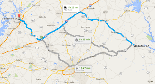
However, what is MORE striking is that when the route is extended to Atlanta, this route is STILL preferred over all other alternatives.  This means that these lowly state routes are in actuality carrying U.S. highway traffic (Image from Google Maps).

PHASE 2: ADAIRSVILLE TO GAINESVILLE

This route would follow the following state routes:
  • I-75 from GA 140 in Adairsville to GA 20 in Cartersville
  • GA 20 from I-75 in Cartersville to GA 369 near Lathemtown
  • All of GA 369 from GA 20 near Lathemtown to I-985 in Gainesville 

The route from Adairsville to Gainesville is clearly defined by Google matching up with typical truck routes of today.  It avoids windy GA 140 east of Adairsville instead following a portion of I-75 to Cartersville then following existing GA 20 and 369 to Gainesville (Image from Google Maps).


PHASE 3: GAINESVILLE TO ROCK HILL, SC

While less important than the two western legs, the need for the route extension further east is still viable.  It presents a badly needed east-west link for traffic as an alternative to traveling through Athens and as a means for bringing economic opportunity to parts of Northeast Georgia overlooked due to the lack of decent east-west routes.  The eastern phase also presents a unique and coincidental situation.  By sheer coincidence, GA 72 east of Athens is not only a major route but maintains its designation into South Carolina until its terminus in the southern suburbs of Charlotte.  U.S. 72 would ultimately assume this route replacing most of GA/SC 72 from Elberton eastward.

The route east of Gainesville is not so clearly defined, and part of this is due to a vital missing link east of Gainesville.  The connection and realignment of two county routes in Hall County would most likely correct this issue, but this does not necessarily mean that this correction is the most viable route.  Google analysis shows that three possible options are viable.  These options are:

  1. Route U.S. 72 along existing U.S. 129 to Athens then along all of GA 72 east of Athens meaning a full U.S. 72/GA 72 overlap.
  2. Route U.S. 72 along GA 98 from Maysville to Comer then along GA 72 east of Comer
  3. Route U.S. 72 along parts of GA 51 and 17 from Gainesville to Elberton in conjunction with other shorter routes.

Option 1:

The first option utilizes only existing state routes.  It follows:

  • U.S. 129 from GA 369 in Gainesville to GA 10 Loop in Athens
  • GA 10 Loop from U.S. 129 to U.S. 29
  • U.S. 29 from GA 10 Loop to GA 72
  • All of GA 72 east of U.S. 29 creating the coincidental U.S. 72/GA 72 overlap
This route is obviously the most simple to execute, but it has a distinct disadvantage in that it does not allow traffic to avoid Athens.  This means that U.S. 72 traffic would be forced into congestion related to Athens instead of by-passing it along less traveled routes through smaller cities and towns.  It is the least preferred option for that reason, but it does effectively establish all of GA 72 as a U.S. route as well as linking existing GA 72 to other routes.  In this plan, GA 316 should become the state overlap of all of U.S. 72 to avoid confusion and because the route would still be "Highway 72".

Option 2:

This option is probably the most logical route giving a completely direct east-west link with the fewest turns.  However, it does require substantial upgrades and intersection realignments where it passes through Hall County.  It also will require a renumbering of the westernmost portion of GA 72 between Athens and Comer.  It follows:
  • Old Cornelia Highway from I-985 to Joe Chandler Road (part of Old U.S. 23)
  • Joe Chandler Road from Old Cornelia Highway to GA 52 
  • GA 52 from Joe Chandler Road to GA 98 in Maysville
  • GA 98 from GA 52 in Maysville to GA 72 in Comer
  • GA 72 from GA 98/22 in Comer to South Carolina State Line

The GA 98 routing gives the most direct east-west route from Gainesville to Elberton helping drivers find a suitable alternate to driving through more congested Athens.  It also helps better locate larger cities such as Commerce and the small Madison County seat of Danielsville.  However, it faces limitations from the need for costly upgrades along the portion between Gainesville and Gillsville since the route follows existing county roads (Image from Google Maps).

Note that this route cannot be added as-is.  Several significant changes would have to be made to make it work.  First would be major upgrades to Joe Chandler Road.  This would include intersection realignments at GA 52 and Old U.S. 23 to make Joe Chandler Road the primary movement, lane widening on Joe Chandler Road, an intersection improvement with East Hall Road and completion of an already programmed bridge replacement.  In addition, both county sections would also become an extension/relocation of GA 98.  Also, two routes would have to be renumbered to make this work.  The first is existing GA 98 north of GA 52, which is recommended for a reassigned GA 207 (out of use for 30 years).  The second is the renumbering of existing GA 72 west of where U.S. 72 joins the route in Comer.  The route can no longer carry the GA 72 number under this plan due to excess confusion.  However, several good candidates are available.  These include:
  • GA 316 eastward extension along part of GA 10 Loop and all of GA 72 including the portions overlap with U.S. 72
  • Re-designation of GA 350 along all of GA 72 including the portions overlapped with U.S. 72
  • Re-designate the existing parts of GA 72 not included in the new U.S. route as U.S. 72 Spur
  • Designate existing GA 72 south of the proposed route and part of U.S. 129 west of Athens as U.S. 72 Alt
  • Extension and relocation of GA 53 along GA 316 and part of GA 10 Loop to overlap all of GA 72 including the portions overlapped with U.S. 72.  Existing GA 53 south of GA 316 could be renumbered or transferred to local maintenance.
Option 3:

This option is the northernmost option and would offer likely the greatest benefit as an east-west alternate route.  However, the existing roadways were not designed to carry an east-west route and would thus require substantial reconfiguration to make work.  Most of this would be west of I-85.  This route includes:
  • Old Cornelia Highway from I-985 to Joe Chandler Road (part of Old U.S. 23)
  • Joe Chandler Road from Old Cornelia Highway to GA 52
  • GA 52 from Joe Chandler Road to GA 323 in Gillsville
  • GA 323 from GA 52 in Gillsville to GA 51
  • GA 51 from GA 323 to GA 145 in Franklin Springs
  • GA 145 from GA 51 to US 29/GA 8 in Franklin Springs
  • Overlap with US 29/GA 8 from GA 145 to GA 17 in Royston
  • GA 17 from US 29 to GA 72 in Elberton

The GA 51 routing is considered because at present it recommends routing traffic along a long overlap with I-85.  While this is an acceptable option, it provides no benefit for communities near the route and dumps addition traffic onto I-85 that is already congested.  However, the route shown here does not consider using county road such as Joe Chandler Road.  The map below shows the same route with the modifications including distance and time to show the advantage especially after upgrades are made (Image from Google Maps).


The second map shows the GA 51 routing removing the barriers presented with routing traffic along an existing county road.  However, the upgrades required west of I-85 are significant and costly compared to the second option that includes only upgrades to Joe Chandler Road (Image from Google Maps).

In addition to the corrections along Joe Chandler Road, significant intersection realignments would be necessary to make this new routing work effectively, handle truck traffic and save time in comparison with other routes.  These upgrades would include:
  • Reconfiguration of intersection at GA 52 and GA 323 in Gillsville to make GA 323 the primary movement and/or construct a traffic circle.  If a higher speed option is chosen, this would require a short by-pass on the NW corner of the two routes.
  • Reconfiguration of the intersection of GA 51 and GA 323 creating a new roadway on the SE corner of the intersection between the two routes.  The new roadway would close the existing GA 323 east of that point and would make GA 323 the primary movement requiring GA 51 traffic to turn off of the new road
  • Realignment of GA 51 intersection at Historic Homer Highway (Old U.S. 441) in Homer to make GA 51 the primary movement
  • Construction of a traffic circle at the junction of GA 51 and 145 in Franklin Springs
  • An improved roadway connection in Royston possibly including the state takeover of Cook Street or a new southwest bypass
  • The construction of a full diamond interchange at GA 17 and 72 in Elberton
PHASE 4: SOUTH CAROLINA EASTWARD: WHERE DOES IT GO?

From Elberton, the route would continue along GA 72 eastward to the South Carolina line.  In South Carolina, the following takes place
  • Route in South Carolina follows all of existing SC 72 until SC 121 in Rock Hill
  • From there, U.S. 72 overlays existing SC 121 from existing SC 72 to its eastern terminus at U.S. 21 with an overlap of U.S. 21 to end at I-77.
    • Existing SC 72 into downtown Rock Hill would become U.S. 72 Spur
  • An eventual eastern extension may one day be possible to end at U.S. 74 in Monroe, NC via a new roadway connecting NC 75 to SC 122
    • This new roadway should be preferably limited access, especially on the new portions
    • A southern route connecting U.S. 21 east of I-77 to NC 75 may also be considered


The map above shows where US 72 would end in Rock Hill (following SC 72 and 121) and the proposed eastward extension.  The northern route in magenta following SC 122 connects the road as a surface highway to NC 72.  The southern route forking off of US 21 would be a freeway or expressway on new alignment ending at an interchange with US 74 east of Monroe.  This new route would create a southern connector from fast-growing Rock Hill to US 74 east of Charlotte.

WHY IS THIS NEEDED?

Northern Georgia and Northern Alabama have been known for many years to have poor east-west connectivity and part of that is due to the lack of a single major route to prioritize upgrades along.  Travelers from Alabama to South Carolina north of Atlanta at present have not a single U.S. route other than mountainous U.S. 76 and rely on a confusing splicing of state routes.  In neither South Carolina nor Alabama have any corridors been developed along these routes with by-passes or four lane sections that are needed to better manage traffic leading to a lack of development along these corridors and dangerous traffic situations as large trucks are using inadequate roads.  This state routes have not been unified in any logical fashion, do not indicate badly needed turns, have not been upgraded in such a fashion to better manage long distance travel and receive weak funding priority due to their lowered status as regional state routes instead of major intrastate routes.  In addition, Georgia has also not added a single mainline U.S. route in over 50 years relying instead on state route "corridors" such as the 500 series GRIP corridors that do nothing but contribute to public confusion.  Fewer designations are needed, and major routes in the state should be part of the U.S. route system in the majority of cases with the GRIP designations dropped due to their needless overlaps of already present routes.  

In fact, the politics of GRIP corridors do not actually line up with route importance in this case.  While the Scottsboro to Adairsville route has the highest need, it has received low priority for improvements by both Alabama and Georgia who both effectively treat it as a regular surface state route.  For instance, GA 48 is shown as a minor arterial instead of major arterial and has received very low priority for upgrades.  In contrast, GA 72 from Athens to the South Carolina line is not only a GRIP corridor but shown as a major arterial.  Some portions are only classified major collector such as GA 369 in Forsyth and Cherokee Counties.  All portions of this route should be reclassified as major arterial along with a renumbering to U.S. 72.

WHAT ABOUT OLD US 72?

Most of U.S. 72 north of Scottsboro does not follow a logical east-west direction before becoming essentially an unnecessary overlap with U.S. 41 and U.S. 64 in Jasper east of I-24.  In Chattanooga, U.S. 72 unceremoniously enters city streets terminating at the exact western terminus of U.S. 76: two east-west U.S. routes ending into each other!  It's a logical fallacy that came as a result of extending routes without thought as to where they would terminate.  U.S. 76 itself is mostly overlapped with U.S. 41 west of Dalton making it extend miles beyond its logical western terminus, so U.S. 74 makes the most sense to replace it.  U.S. 74 at present ends at the junction of I-75 and I-24, but it is not signed past its interchange with I-75 near Cleveland.  By signing U.S. 74 and extending it westward along I-24, U.S. 74 can easily and cheaply replace U.S. 72 between I-24 in Jasper and AL 35 (proposed U.S. 72 relocation) in Scottsboro.  Better yet, extending U.S. 74 effectively ties two APD corridors together: Corridor K and Corridor V.  In no way is the importance of Corridor V diminished, and in fact U.S. 74 becomes effectively a longer route tying Huntsville to Cleveland, TN through Chattanooga.  This extension effectively eliminates at least two logical fallacies leaving only U.S. 76 to correct (which will likely come later since a new route is planned from Dalton to Trenton that could carry U.S. 76 on a better route).  It also better unites two corridors that function much like surface interstate highways.


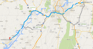
Corridor K and Corridor V can be linked together in a logical fashion by simply extending U.S. 74 westward along I-24 to take over U.S. 72 up to the relocated portion in Scottsboro (Image from Google Maps).

WHY THIS IS BETTER

Moving U.S. 72 onto these major routes through Alabama, Georgia and South Carolina will only consolidate what people have already known for years, but the purpose will be better travel and hopefully greater emphasis on upgrading this very substantial yet substandard route.  Most sections of this route are long overdue for a major overhaul including four laning, interchanges, new by-pass sections and intersection relocations to better reflect traffic patterns.  Unclear routes also discourage economic activity in all of the cities along this route due to difficulties involved in shipping and commerce.  At this point, the plan is simply to add a number to existing roads, but the hope is that in the future it will improve the economies and connectivity of all cities along its route.  

Monday, August 31, 2015

Regional Road Maintenance: Answers to Questions and Customization for Local Needs

Discussing the regional road plan with people has seemed to result in a lot of confusion as to how the plan works.  This proved that further discussion is needed into what a regional road plan actually means. In Part 2 of the original plan, it was discussed that three different options were available for such a plan.  Before discussing these, it is important to address the issues that were brought up that are viewed as problematic.  The greatest issues brought up in regards to this plan are:
  1. Agencies are created out of thin air.  Thus, by all appearances they are too large to be involved with what should be local matters with not enough accountability.  This creates the potential for abuse of power. 
  2. Regions appear to be too vague in their boundaries and overlap each other making them susceptible to conflicts between agencies under the regional agreement.
  3. The creation of another layer of government would drive up costs while not really improving quality.
  4. A region seems like an unnecessary layer of government when you could just have the state provide road maintenance for the local governments.
  5. Regions are still too big.  A county is a big enough unit of government to handle local matters.
Agencies are created out of thin air.  Thus, by all appearances they are too large to be involved with what should be local matters with not enough accountability.  This creates the potential for abuse of power. 

Regional roads present an issue that is unusual in government in this country: the issue of creating a cooperative.  Obviously a cooperative presents a unique situation where decisions are made democratically by partner agencies instead of operating under a sole government structure like with a state DOT or county.  Is this a bad thing?  Nonetheless, these issues presented above were all considered when the plan was first written.  That is why this plan was written and revised considering all of the doubts and criticism over challenging the status quo model.  The issue of accountability is a tough one, because with road maintenance any level of government can be aloof and irresponsible with public funds.  Just like with a county, city or state there is no guarantee that every region will do a great job or will not be tarnished by corruption.  The hope is that these issues will be minimalized by the division of powers present in this system by keeping construction funds local while limiting the powers of the cooperative to engineering and routine maintenance.  In addition, the creation of an elected position just for each regional agency will also help to increase accountability.  In any case, a large pool of money is basically being entrusted to a few individuals making decisions on where roads are built, how much is spent, which roads are fixed and how well any of that is done.  For comparison, some states do a much better job than others.

What has been made very clear throughout this site are that the smallest local governments cannot be trusted to maintain roads to proper standards whether or not the roads are closer to the people.  While these roads are closer to the people, you have a number of potential issues that affect the ability of a local government to provide high standards, including:


  • Poverty: County or municipality simply does not have the resources to provide much on their own
  • Apathy:  Road maintenance or road maintenance standards are a low priority to the local governing body
  • Ignorance:  Local agency is not aware of what constitutes proper standards or practices and nobody has made them aware of the problem
  • Cronyism:  Agency is staffed properly, but is staffed largely with friends and relatives that 
  • Stinginess:  Local agency knows their roads are inadequate, but does not want to put out the funding necessary to provide proper equipment, staff and training nor spend an adequate sum on materials.
  • Laziness:  Nobody working on a local level cares about making the extra effort to properly supervise road maintenance even if the money is there.  Often tied to cronyism


Any combination of these issues is often the case, and even if the factors are right for awhile, this can quickly change.  It is not that these factors do not also exist on a state level, but there is safety in numbers.  A large enough population and higher levels of scrutiny by citizens and attorneys alike are more likely to keep a larger agency on their toes as to what is right and wrong.  The smaller agencies can plead poverty (not enough money) or ignorance ("Nobody ever told me that before, so I never thought it was an issue"), but the creation of regional roads as an option is designed to eliminate excuses.  If they are too poor, too ignorant, to cheap, too lazy or just do not care about keeping up their roads correctly, they should be encouraged to exit the road maintenance business redirecting their funds to an agency that is never incapable of anything related to roadway standards.


Burnet County, TX is just one of many counties in the country who are too small or too numerous to be accountable in terms of road standards.  This unmarked 90 degree turn on a county road demonstrates that the county has skimped on traffic control to fund other roadway priorities.  If grouped into a larger region such matters that are currently viewed as excessive in cost by the county could become routine for a more technocratic regional agency.  Nevertheless, the same region would be centered near or not far from Burnet County (most likely in an Austin regional system not connected with TxDOT) in lieu of being operated as a division of the TxDOT centered in Austin.  (Image from Google Street View).

Inversely, what has also been made clear is that state government is not always accountable with local level roads.  The controversies surrounding the centralized structures in Virginia and South Carolina are precisely what gave birth to the partially-decentralized regional node model.  With states refusing to raise revenues, diverting funding away from transportation, and putting pet projects ahead of maintenance it was considered that the state's role in maintenance on roads not otherwise designated state highways should be limited to maintenance and not construction.  Nevertheless, regions might be a good middle ground.  Even in Virginia it was proposed on Part 3 to create regional systems in the larger metropolitan areas while keeping the centralized state models in the rural areas less adept or capable of operating a successful regional model.  

Regions appear to be too vague in their boundaries and overlap each other making them susceptible to conflicts between agencies under the regional agreement

Because it is still a subdivision of the state, a region would obviously be far more accountable than either the state or the local governments.  It would be both removed from local politics while likewise being responsible to a specific region of similar needs and characteristics.  It means that neither a rural area and large city nor two cities will not have to compete for the same dollars when it comes to local level roads, but it also means that the revenue sources will be ample to provide state level maintenance on local level roads.

It was initially proposed just to have a minimum population threshold as the only plan on how to form a region, but an additional criteria was added based on the federal regional planning commissions.  This means that you have three required categories:


  • Minimum population threshold of 300,000 residents
  • Once the minimum threshold is met, regions must be tied to the boundaries of regional planning commissions
    • Regional planning commissions should not be confused with metropolitan statistical areas.  RPC boundaries encompass every county, municipality and township within a state
    • During the formation of regions, initial partnerships should not be restricted by RPC regions.  They should be divided off once every potential RPC region has at least 300,000 residents among its member local governments
  • If regional population falls below 300,000 residents, the region must partner with the region with the next smallest population
    • If the next smallest region is already partnered, then the region may partner with any other available region
    • The region with the next smallest population is preferred if it is available


Picture if such a system exists in Texas.  Texas is clearly too large for a fully centralized road system, but a state within a state concept would help tremendously.  Here are the figures for Texas:
  • 254 counties: the largest number in the United States
  • A state population of 27,695,284
  • Texas counties range from 82 residents (Loving County) t4,092,459 residents (Harris County).  Many Texas counties have less than 1,000 residents and the largest population counties are carved into numerous cities and towns.
  • The proposed rural regions are designed to have at least 300,000 residents
  • 24 regional planning commissions exist in Texas

  • This means a maximum range of 55-92 regions thus consolidating road maintenance into far fewer entities covering far more terrain.   
  • 24 MSA regions exist to successfully group urban and rural counties together
  • The four largest MSA regions range from 1.7 million residents (Austin) to 6.4 million residents (Dallas-Fort Worth).  This would range from a combined approximately 4 regions in Austin to approximately 13 combined regions for Dallas-Fort Worth.
  • The combined metropolitan regions would most likely result in an actual sum of 25-30 regions statewide.
  • Texas has 1/4 of their roads under state control, but the regional model would permit TxDOT to transfer ownership of the farm-to-market roads to the regions in addition to the majority of county and municipal roads in the vast rural areas across the state.
  • This division into regions would provide state-level maintenance to the local level for all of Texas while keeping funding localized to regions surrounding the state's largest cities.  Money for regions would not be doled out by Austin.  San Antonio would not have to compete with Dallas for funding and a large remote region in West Texas would not have to compete with Corpus Christi for dollars.  
  • The regional plan frees the lower population counties to focus on other matters while making sure that roadway dollars stay close to home.  San Antonio road dollars stay close to San Antonio but will also extend beyond the Bexar County line to help the eight surrounding counties improve their own standards and stretch their local dollars further.
The Texas example lays out how with a top-down population restricted model that state level efficiency can be achieved while not centralizing everything into the heart of state government.  The state-level centralized model works best in small states, but not so much in very large states such as Texas.  Of the four states that currently use the state-level centralized model, North Carolina is the largest.  For comparison, North Carolina's entire state controlled road system covering every county road still has fewer miles than Texas's non-centralized state highway system which controls 25% of the state's roads.


They say don't mess with Texas, but the road system could stand to be messed up in a good way.  Far too large for centralization, but far too fragmented to provide consistent road standards this plan carves the state into clusters of single purpose city-states for the sole purpose of road maintenance.  In the majority of cases the state-owned primary and farm-to-market roads would be maintained by the regions shown here along with most county roads and municipal streets in all the areas shown.  Because of the very low populations in rural areas and the very high populations of the metropolitan statistical areas, these regions cover a huge number of counties.  The smallest of these districts still has over 300,000 residents.

The concept of regional roads is a "city-state" model where 1-2 larger cities are sharing resources with the less populous surrounding areas.  For instance, Houston metro alone has 6.6 million residents: roughly the same population as the entire state of Massachusetts and only slightly less than Washington State!  Couldn't Houston alone greatly benefit all 10 counties in the region especially lower population Austin and Chambers Counties?  While regions would be somewhat more distant than a county, city or town, they would still be able to do a much better job than a smaller agency on their own.  Nevertheless, people do not want to deal with an aloof agency with no public connection.  As a result, controls were proposed for regions including boards that include local elected officials.  Another possibility is term limits for all positions and/or elections for chief traffic engineers thus rotating the position.  Regardless, the outcome of having a traffic engineering team overseeing a large number of roads that is able to pool resources and funding is going to be much better than a small county, city or town doing the same without the resources to fund traffic engineers, staff or purchase higher cost materials to complete the job.  When a geographic area made up of many small jurisdictions can act as high population area through one single agency, the potential for better roadway standards greatly increases.  Hopefully the Texas example demonstrates how this can work.

One thing that has been made very clear about the outcome of regions is that these are NOT overlapping entities.  They may overlay counties, cities and towns within the region but the boundaries are set and are set top-down.  With exception to pilot projects, the idea is that all parts of a single state must fall into at least one regional road district in effect carving the entire state into smaller regions that are much larger than single counties, cities or towns.  The boundaries touch each other, but they do not overlap.  This is not an issue of individual counties/cities opting out if they want more control or the establishment of vague and gentlemen's agreements for various services.  This is designed to be a clear and very public mandate that creates more local control than a complete state takeover of local roads and streets.  It has the express purpose of making sure that road funding creates the highest standards and is most effectively and efficiently spent.  Significant autonomy was worked into this plan for local agencies, and the general position is that regions primarily handle engineering and road maintenance with local agencies handling construction funding.  Picture in the case of Texas that Texas is essentially carved into 25 separate phantom states except that these 25 "states" are single purpose districts instead of general purpose mini state governments.  While it could be a model for regional autonomy, this is NOT the idea behind this plan.  All counties, cities and towns listed still retain the same powers they have except those exclusively given to the regions for roads.

The creation of another layer of government would drive up costs while not really improving quality

Another view of regions is that it will just create another layer of government.  Regional road systems are not a general purpose unit, and they are designed to replace full local government responsibility for road maintenance of non-state roads in the vast majority of cases.  They also do not carve up existing counties, cities and towns into smaller unit.  By design they are no smaller than a single county and in most cases much larger.  They serve a single purpose: to supervise the construction and maintenance of roads.  The plan is that they will assume the entire responsibility that is currently entrusted to smaller local agencies with exception to higher population counties and cities that are able to handle controlling the more local streets.  In those exceptional areas, regions would still be required to maintain federal-aid eligible roads not otherwise owned by the state and would also typically maintain state roads on behalf of the state.  As a whole they are designed primarily to relieve local agencies of road maintenance duties for the purpose of raising local road standards and improving cost efficiency.  While boundaries for regions would be flexible based on population changes, the boundaries would completely cover the state meaning that no agency is allowed to completely opt out once the regional plan is established.  Opting out would by necessity be restricted thus limited to only certain functions and/or certain roads as laid out in the three types of regional systems described below.

A region seems like an unnecessary layer of government when you could just have the state provide road maintenance for the local governments

The above example with Texas points out the reason why this statement is unrealistic.  The sad reality is that states for the most part would like to be out of the road maintenance business, and the huge population increases in the majority of states mean that the states would prefer to at least reduce, not expand their roles.  With the increased polarization of the population to larger cities, the balance between rural and urban needs no longer exists.  Urban areas need new roads and larger roads more quickly while rural areas do not want to be left behind.  Urban areas do not care if some far flung portion of the state does not have enough money to pave their roads while rural areas do not want to see a large chunk of the state's budget used just to rebuild a large interchange that could be used instead to improve a much longer major highway in their area.  When those same dollars are spread down to both the smallest subdivision street and gravel track with three houses on it, it creates the potential for conflict meaning the the states in turn want to concentrate all available dollars to the major roads with the greatest needs.  In this concept the state can turn more responsibility away without transferring it to a unit of government too small to keep the roads maintained to the same levels that the state had prior.


The potential is there for something much better than what we have today.  These two images show a well-engineered sign program for Jamestown Road in Chattooga County vs. what is unfortunately actually there.  It is designed by GDOT as minor collector, but is actually an important road extending over a long distance connecting Gadsden, AL to towns and sites in Broomtown Valley.  However, that will never happen as long as status quo is maintained (and obviously in a very half-assed way).

Having a more centralized, coordinated system based on regions gets rid of information holes created by multiple small jurisdictions that exhibit little interest in the functional needs of the road such as roadway realignments to eliminate unnecessary turns/doglegs, posting directional guide signs, and posting trailblazers.  Although signed for "New England" from I-59, Slygo Road has no further signage describing the two addition turns needed to reach it nor does it relay the needed turn to connect to the original highway, US 11. 

Along with the funding disputes, state DOT's laced with aging infrastructure also want the legal responsibility for less traveled roads off of their hands.  Moreso, state legislatures do not want to take credit for a huge tax increase required to maintain a larger road system at the same levels as in the past preferring to pass the responsibility to the local governments.  Local governments in turn do not want the state to dictate road standards including how and where road funding is spent.  This argument is not new.  The problem is that most local agencies are not suited for this responsibility and never will be.  They are too small in funding, road mileage responsibility, the structure necessary for a professional DOT-level agency, and in economies of scale required for efficient distribution of funding for both low and high cost improvements.  If the state completely refuses to offer to work as a contractor on behalf of these counties, where else can they turn?  This is how the regional idea was born.  The regional idea is designed with the intent on bringing state standards to local roads without having to funnel all of those funds through the state capitol where competition for funds strips funding from the local level.  The state conflict may not be solved, but this does not mean that regional matters should be forced on a small local government that lack the resources to do what a state or high population area can do much better.  The regions bring high population agencies to every corner of the state without relying on the state.  The fact that Georgia has the population to support multiple regions is the same reason that a centralized state agency is a bad idea: the ratio of employees to citizens on both levels is very out of whack.
 
Regions are still too big.  A county is a big enough unit of government to handle local matters.

Very few parts of the country are able to see past this big lie that local control via counties, cities, and townships are an excellent way to manage roads.  The entire myth of this has to be at least a product of "NIMBYism" where the priviledged few that "got there first" get to hoard any available road funds just for them and be damned the rest of the state, a neighboring county, etc. as if their county, city, etc. is a big country club surrounded by the undeserving abyss.  What they fail to notice is that THEIR costs go up, quality goes down, and taxes also go up.  Inversely sharing services does NOT mean sharing everything.  Let the counties, cities, and towns build what they want, but that doesn't mean that they are going to provide suitable routine maintenance.  That is the goal here: to get both the state and the counties out of a business that they are failing at.  It is the creation of "just right" government vs. too big (GDOT) and too small (159 counties and over 500 cities).  The regions proposed here are likely no larger than the largest counties in Arizona or California, but they will have much larger populations to work with as a means to raise adequate funds for all roadway services. 
 
As was stated in another post, a low population county, city or town does not provide an efficient model for local services.  While proximity to the people has always been an ideal of small units of government, certain services cannot be provided at acceptable levels on a local level unless both the population is there and roadway services are shared among the municipalities in that county like they are in most cities in Los Angeles County, California.  In an ideal situation, a state will simply provide services to local governments as a contractor paid for by local funds or a retainer where their economies of scale, population and funding are just too low to handle it themselves.  In theory these local agencies would see that they are not able to do what the state or urban counties can do and ask for relief where the state then steps in and provides those services with no complaints from anyone.  A means test would be applied to those who do provide it, and an expectation that state and federal standards would be placed on all local governments along with ample funding from the state government.

In truth, the states rarely step in.  Outside of a few high class zip codes, most local governments are often teetering on bankruptcy with failing schools, inadequate facilities, and a total lack of accountability given the rampant nepotism found in local control.  Likewise, many local governments resist help when it is available because they put politics ahead of the public's best interest.  Typically local political machines are operated by just one or two wealthy families in the small communities with the only real accountability happening in more transient areas with higher populations.  Just because a person can drive 5 miles to talk to the mayor or county commissioners does not mean that either is willing or able to fix the problem.  Most likely the person in charge of fixing the problem is related to someone else and in that position for that reason alone not because they are actually qualified for that position.  While cronyism is found in all levels of government, it is routine in rural local agencies.


The perception people have of local roads and streets.


An actual local road (major collector carrying state highway traffic).

It should also be pointed out that nearly every county, most cities and most townships across the country were not designed with any intention of being able to handle road maintenance.  When they were established, most people were not even driving cars and most roads were unpaved wagon trails.  Modern traffic engineering expertise was thus needed less often and quite often road work was handled in a manner similar to jury duty with compulsory work crews brought in to repair and maintain roads.  Today, a typical county has the majority of its roads paved and must include as much as 50% of their budget for roads thus reducing available funds for other services.  With such a high demand, this leaves little left for items that are manageable for a larger unit of government such as traffic engineering services and specialized equipment.  Hiring contractors to do local matters has a profit motive thus additionally driving up costs forcing a local agency to permanently cut corners in a number of areas.  Most of these counties and townships would willingly hand the direct responsibility up to a higher level of government as long as they were able to maintain control over planning and have funding available to continue local construction projects, but right now nobody is offering!  The regional model is designed to make this easy for all local governments.

THE THREE TYPES OF REGIONAL ROAD SYSTEMS

As was discussed before, three different models are proposed for regional road systems.  These have varying degrees of control and responsibility.
  1. Regional highway systems (A proportion of roads deeded to the region with local control retained for local streets)
  2. A comprehensive regional system (All local road maintenance in the region consolidated into a single agency)
  3. Regional engineering districts (Local control retained, but traffic engineering and traffic control consolidated into a regional agency) 
Among these types include combinations of these three types of systems as described below.

Regional Highway Systems

In regional highway systems, a portion of sales or gas taxes is transferred to a regional highway agency for the purpose of maintaining regionally important roadways that are not otherwise owned or maintained by the state.  A regional highway system can be roughly compared to the county road systems found in the upper Midwest where counties are responsible for mostly federal-aid eligible roads while townships are responsible for the truly local streets.  Thus, a regional highway system provides a three-tiered approach on a level higher than a county.  Here is how they would compare in different regions of the country:
  • In the Southeast, a regional highway system carves off the most important county roads and municipal streets to be maintained by a region covering multiple counties and cities.  County roads and city streets would still exist, but they would be limited to roads that actually are functionally local while higher classification roads are the responsibility of either the state or region.
  • In the Northeast, a regional highway system would cover multiple townships not necessarily overlaying existing county boundaries if no county highway system otherwise exists.  They would be based on population and township/municipal boundaries instead of the boundaries of the otherwise defunct counties thus a region may include part of a county, all of a county or parts of multiple counties.
  • In the Midwest, a regional highway system would replace the county road system.  In these states, county authority for maintenance would be replaced with regional authority.  While this would mean fewer agencies involved the overall structure would remain with counties maintaining generally higher classification roads.
  • In the West, a regional highway system would likely be less common due to the size of the counties and lack of population in outlying areas.  They would most likely exist closer to large metropolitan areas as well.  Most regions would either be single counties plus the cities except in rural counties where the population is low if they are used at all.  In very low population states like Wyoming or Idaho a regional road system would consist essentially of a separate division of the state DOT working on behalf of the counties and cities meaning a separate state agency.
  • In very small states, a regional model may not work since the population and land area is already low enough that the state could essentially handle those services more easily with the population too low to form more than 1-2 regions.  In states like Vermont and New Hampshire, a regional road system would more than likely end up being the consolidate of engineering services and certain roadway functions to the state level.
While these regional roads under the first type would still be mileage-limited highway systems, a fundamental difference is that unlike the approach states are taking functional consolidation would still be pursued for remaining roads and streets.  This means that the region would typically handle maintenance for county, city, town and township road they do not otherwise own.  The difference in this model is that regions would not own roads beyond the roads they are required by legislation to maintain.  In these cases either the county/city/town voluntarily opts out of road maintenance handing the responsibility to the region and/or the local agency is required to use regional forces if the population of the local agency is too low.  Either way, the local agency and not the region would own those roads and would be responsible for their financing.  This means that basically the county/city/town pays the region to maintain their roads and streets while retaining exclusive jurisdiction for planning and financing larger roadway improvements on those roads.  The regional routes, on the other hand, would be collectively funded similar to state routes and would be solely regional responsibility.  Regional highway systems would likely also be contracted to handle routine maintenance of state highways within their regions similar to the set up that currently exists with county roads in Michigan and Wisconsin.

Elements of this plan can be compared to the Secondary State Roads Plan, Two Way Consolidated Road Maintenance Plan and Cooperative Maintenance Plan

Regional Road Maintenance Consolidation

In theory, the ideal plan is to cut out the middle man and transfer all roads presently designated county, city or town to the regional road agency.  This approach would provide the greatest cost efficiency and least bureaucracy.  It would be similar to how North Carolina revoked authority of counties to maintain their own roads except that in this case it would be handled by the "state within a state" regional agency.  Another fundamental difference from North Carolina is that the regional road maintenance includes cities and towns while the North Carolina approach typically limits or excludes cities and towns.  Why this approach was not considered exclusively is because a consolidation measure that completely revokes local authority by transferring that responsibility to a larger agency is controversial.  Accountability may be more difficult to achieve if the regional agency is solely responsible for every road not otherwise maintained by the state. 

Nevertheless, a rural region may willingly adopt such a strategy.  If a region consists entirely of lower population counties or townships, obviously these local agencies will not be financially capable of providing state-level maintenance standards on their own for any road and may be struggling to fund road maintenance at all.  Unlike a state where a transportation plan must be evenly applied statewide, individual regions have flexibility.  While a more urbanized region may adopt the  first regional highway plan, a rural region where all counties have low populations may be more willing to completely transfer responsibility to the region.  In this case, a region would likely gain complete taxation power with all local agencies avoiding direct responsibility other than seed funding road improvements through local property taxes.

Elements of this plan can be compared to the State Contracting Plan and Secondary State Roads Plan.

Regional Engineering Districts

A regional engineering district is the most stripped down portion of the plan.  While it is less likely to be cost efficient, it would be just as effective in improving road standards.  The idea of a regional engineering district is to consolidate traffic engineering into one unit while otherwise retaining local control.  This means that while every local street department remains intact, day to day operations fall under the authority and supervision of a regional traffic engineering unit.  The regional engineering district is also the primary method which local agencies could combine forces without any state involvement.  Essentially all counties, cities and towns involved pool resources to fund a regional engineering unit who is responsible for providing engineering for all agencies involved.  In such a plan the engineers look for ways to streamline certain functions and responsibilities while keeping others separate.  

A regional engineering district should retain one duty exclusively in such an arrangement and that is traffic control.  Federal guidelines state that traffic control is required to be supervised by a registered civil engineer which most local agencies lack.  Thus, traffic control is consolidated into a single unit serving the entire region so that every single road and street has traffic control handled by a staff of engineers.  This means a single traffic operations facility, joint purchasing and engineering decisions made by a team working for the entire region.  Other efficiencies that could be adopted include shared equipment, shared materials (street cleaning, mowing, plows and road salt) and co-location of facilities.  While each local agency would otherwise by responsible for constructing and maintaining their own roads, the specific responsibility for traffic control and implementation of roadway projects requiring a civil engineer would fall to the region.

It should also be noted that for best results state maintenance standards should be applied in all regional engineering districts since the population and revenues would be sufficient to cover higher cost materials.  This means that traffic control devices installed and maintained by the region should be in substantial compliance with both the MUTCD and state standards.  The beauty of the concept of regional engineering districts is that the state will be able to far more easily supervise regional work and mandate best practices while a county, city or town can claim weak finances or local control as an excuse to shun them.

It is also important to note that civil engineers are among the highest paid employees of any local agency, which is why they are typically not affordable for most local governments without special state funding in states with a large number of counties.  Not all states offer this.  Alabama is a good example.

  • In Alabama, county engineers are paid $90,000 a year.  
  • This covers 67 counties meaning that the state pays $6,000,000 or 1.2% of the state's roadway budget annually for this purpose.
  • If Alabama carved the state into 12 regions (with an average population of 400,000 residents per district), the state could have four engineers per region budgeting 48 engineers a year after attrition. 
  • This means a cost savings of $1.7 million with a better distribution of workload and/or a raise for the chief engineer to $125,000 a year: still 75% of the initial $1.7 million savings.
  • This would also create a team of engineers meaning that greater accountability and specialization is possible than with a single county engineer.
  • In addition, if additional engineers are needed a region could easily fund an additional employee.
  • This also means that all engineers working for the region will have plenty to do handling at most 100,000 miles a piece when at present the responsibility ranges from a high of 650,000 residents in Jefferson County to a low of 9,045 residents in Greene County.  
  • In the region including Greene County, the county would need to budget $2,245 per year to fund an additional engineer if funded on a proportional population ratio basis.  Obviously the Greene County engineer presently does not have enough to do.

Considering this number, a team of at least three engineers is preferred running at about $270,000 a year for a region of 200,000 residents.  If this is split among for instance eight counties, each county pays on average $33,750 a year meaning that they pay nearly a third of the cost for three full time engineers when just one would have costed them three times as much.  Having a team allows specialization and less dependence on state forces for technical matters.

As was also stated before, the regional engineering district is the best approach to start a pilot project for regionalization of roads.  The engineering district is the bare bones approach to regional roads where the organization is in place but can just as easily be dismantled because the structural changes are very limited covering what could be as few as 10 full time employees.  The success or failure of a pilot project should be used to determine if a more permanent approach (the first two options) can be chosen since real cost savings are less likely to be achieved maintaining separate street departments under a region.

Elements of this plan can be compared to the Consolidated Traffic Operations Plan

ONE SIZE DOES NOT HAVE TO FIT ALL

In a statewide road system, flexibility is not typically allowed.  One DOT district cannot decide to maintain county roads while another refuses to do so.  Individual districts also have no authority over taking over or turning back roads relying on the DOT board to make those decisions.  This makes the process even more political when a more logical means can be used to designate such roads within a smaller region.  While state laws and guidelines are needed, this does not mean policies and goals cannot differ per region.

Consider a region involving a large metropolitan area such as Atlanta.  The Atlanta metro region would most likely adopt the highway system approach consolidating the most expensive roads to a metro region to streamline costs for maintenance while retaining local control for more lightly traveled roads and streets in subdivisions.  A rural area on the other hand may not want any direct road responsibility at all considering that the costs take too much of the local budget.  Unfortunately, in most cases it may be difficult to radically reform the road system due to home rule.  In those cases, an engineering district may be the solution allowing a form of regionalization that is highly specific and limits direct control to only technical matters.  This version incorporates the "consolidated traffic operations plan" while the former plans are closer to the secondary state highway system plan and state contracting plans.  In this plan state maintenance levels can be achieved without having to operate on a statewide level allowing a more voluntary approach to shared services in other areas.

Single-county regions would typically have a hybrid of the either the first and second plan or first and third plan maintaining major streets in the cities and towns within the county while maintaining all county-level roads if townships are not present.  Monroe County, NY has a hybrid of the first and third plan (see page 6) where the county handles traffic control for both the largest city (Rochester) and all of the townships within the county as well as consolidating some other functions.  Nevertheless, local control is retained making it an example of the "regional engineering district" plan involving a metropolitan area.

In all, the beauty of the regional plan is that local control is retained in respect to a larger region in lieu of a single county or municipality or an entire state.  If adopted by states across the nation, it would result in substantially higher standards and cost savings without the complications involved in centralization to a state level.  This plan is tailored essentially to benefit states the most that are either too large to be operated from a state level or too fragmented to efficiently manage from a local level.  The main issue, however, is that the plan must be laid out clearly in a top-down fashion essentially requiring the reorganization of local governments to provide road maintenance services in a fashion that is more typical of state government and less typical of small local governments.  The idea behind this is to achieve sound engineering practice, more balanced road maintenance and supervision by qualified personnel often missing on a smaller local level.  Hopefully the issues that have been brought up have been clearly addressed and the more detailed explanation of the three options will clear up confusion as to what exactly a regional road system entails.

Friday, July 10, 2015

A Critique of Georgia's Off-System Safety Improvement Program & Tennessee's Spot Safety Improvement Program

Much praise can be given to the states of Georgia and Tennessee for finally addressing the lack of progress local governments have made in terms of traffic control and safety improvements.  As recently as a decade ago, local governments were required to raise their own funds for any safety improvements.  The result of this was terrible maintenance in the vast majority of counties and cities.  Local resources were scarce for this work, training was poor and both materials and labor did not comply with proper state or federal standards.

Starting in 2004, Georgia began to lead the way to address substandard maintenance of traffic control devices.  Tennessee followed suit with a nearly identical program in 2009.  Georgia's began with a pilot program, and this program was created to address this most neglected aspect of local road maintenance.  It provided specific funding for:

  • Traffic signs (regulatory and warning)
  • Traffic control studies
  • Pavement markings (striping, raised pavement markers, other pavement markings)
  • Guardrail repair and replacement
  • Mowing and brush cutting to provide better visibility 

Prior to this program, most local governments did not take this type of work seriously.  While stop signs and street name signs were obviously more frequently maintained, most local governments were neglecting this work.  In addition, other traffic control took more of a backseat when rural counties became responsible for posting D3-1 street name signs: a major local expense.  Old, worn out signs were common.  Many signs were 20 up to even 40 years old.  Local governments were likewise doing this work without any direction from a qualified traffic engineer.  The result were dangerous errors and omissions on road after road.  It was the equivalent of driving at your own risk.


What a difference proper safety improvements make!  This steep drop-off into Wolf Creek on Owltown Road in Union County previously had no signs warning of the hazardous condition along with inadequate pavement markings.  Federal-aid funding fixed this dangerous condition, but will county forces be able to keep it up?  These have been needed since the road was first paved in the 1980's.

Georgia's interest in this program coincided with a change in policy in the FHWA in regards to local safety improvements.  It was discovered that the highest accident rates and deadly crashes were not on the busy urban streets but on rural roads.  Duh.

When you have thousands of local governments thinking traffic control is a luxury item, it is going to cause people to get killed.  Thus, the federal government began funding safety projects if the states organized an acceptable means to distribute the funds.  As Georgia's plan evolved, the state has taken an increased role in making sure the projects have been done correctly.  The initial program mostly involved striping projects and replacing traffic signs in place with no engineering studies.  Today, the state's work includes full-scale renovations of specific roads awarded to counties, cities and towns on a first-come first serve basis, but proper traffic studies are by no means a uniform approach with only some districts and some local agencies taking this badly needed extra step.

In all, this plan has led to significant improvement, but the results are still very patchy.  It can easily be said that the majority of roads have still not been covered.  Many, many local agencies just replaced their existing signs without making any modifications, and GDOT's District 6 in particular has avoided financing traffic studies to correct engineering errors present along those roads.  Thus, in many cases an unsafe condition was replaced with another unsafe condition posted at the proper height that is easier to see at night.  Obviously other areas do not need as frequent of maintenance and have improved: especially road striping and guardrails.  If anything, both of those were vastly improved over the typically non-existent lines and neglected guardrails found on county roads prior to 2004.  Nevertheless, even guardrails sometimes need frequent repair.  A crash-prone guardrail cannot just be replaced once every 20 years.  It may need to be replaced more frequently: something that just does not happen in either a rural county or small city/town/township.

In all, maintenance is not a project to be rewarded infrequently.  It takes a constant effort to make sure that everything is where it needs to be, is done right and is continuously up to code.  Will these states shift their efforts when these federal-aid projects have fixed the majority of issues?  We can only hope so, but for now the plan as it exists could stand to have significant tweaking.

THE ISSUES WITH BOTH STATE'S METHODS

The federal-aid safety projects through the High Risk Rural Roads Program (HRRP) have made a huge improvement in the engineering and quality of county roads across both Tennessee and Georgia.  However, in many ways it is a big bandage covering a bigger problem in the two states who do in terms of traffic control devices.
  1. The issues requiring a complete overhaul should not have been present in the first place, especially on federal-aid eligible roadways.
  2. While the projects address most of the present safety issues, they do not address the larger issue in that these local agencies are still not equipped financially or structurally to maintain technical traffic operations work.
  3. Many errors exist on these sign projects that are never corrected on a local level
  4. Projects are spotty and happen every 5-10 years.  They do not overhaul entire road networks in individual jurisdictions.  Instead, they only address specific roads.
  5. Neither state provides any maintenance nor traffic engineering services once these projects are complete
  6. Guide signs are completely omitted from projects except for in-place replacement with no design modifications if the original signs were incorrect.  Proper guide signs should be considered part of safety and should be funded by the state even if federal funds do not cover it.
  7. Traffic studies are not always performed on these projects resulting in signs that, while MUTCD compliant in design, height and reflectivity are not properly engineered thus creating a greater hazard since they "appear" correct.
  8. Local governments are under no obligation to either maintain to the same standards nor eventually replace these signs under another agreement.  They will do little to nothing if another state administered federal grant is not provided.
  9. Funding is not committed from a state level.  While there is (now) a state funding match (in Georgia), it is largely a federally-funded program.  The program will end if the federal program ends.
  10. Federal funding in this program competes for other safety funding including on the state highway system meaning the funding could be stripped away from local governments to use exclusively on state-owned roads or used for purposes other than traffic control.
  11. Local governments have broad powers to choose these projects and can decide against them if they do not want to maintain costlier compliant signage meaning that some local governments with the worst conditions deliberately opt out of the program.
  12. Safety projects are often oversigned and are not planned with any consideration of the financial or structural capabilities of the local governments in maintaining them.
Below each point will be detailed in a single paragraph:

The issues requiring a complete overhaul should not have been present in the first place, especially on federal-aid eligible roadways

First, it should be noted that a complete sign overhaul proves that both the state and local agency was aware of a problem but was unwilling to do anything about it before work was commenced on a federal-aid safety upgrade.  If the road was being properly maintained in the first place, there would be no need for a full-scale re-engineering nor replacement of every sign.  Clearly in these situations both the local government and the state have failed in their duties.  The local agency has failed to set aside funding and properly supervise their own road system while the state has failed to develop a strategy where local work is properly inspected, planned and/or funded.  The result is that an unsafe condition has persisted for decades that has, in fact, only been addressed adequately for the first time.  Regardless of the improvement, the division of funding and responsibilities has failed the public and should be viewed as a serious concern.  If the traffic control devices were maintained correctly as it is, this work would consist of nothing more than small spot corrections and replacement of worn out signs.  A complete re-engineering demonstrates one of two things.  The first is that traffic engineering work was inappropriate, obsolete or incorrect in the first place.  The second is that no engineering studies have ever been conducted at all along a stretch of road.


Stinking Creek Road (NFA 1280) westbound at D.W. Baird Lane in Campbell County, TN.  This road was paved and realigned as a federal-aid project in 1960.  Note that the sign in the image is delaminated, which typically happens to traffic signs that have remained in place too long.  Even if this sign is replaced tomorrow, this shows that Campbell County has neglected traffic control for 55 years.  Image from Google Street View.


Farner Road southbound in Polk County, TN.  This sign was likely installed when the road was first paved and is covered in lichens (as well as faded to pale yellow).  While some other signs on the road were eventually replaced, many others are missing or incorrect.  This shows the half-hearted effort by the local agency.  Replacements also contain many errors like what was described in the discussion on curve warning signs.

While the projects address the issues, they do not address the larger issue in that these local agencies are still not equipped financially or structurally to maintain this technical traffic operations work

This situation of course highlights the point that the majority of local agencies are not able to handle traffic control to the levels necessary.  Budgets in low-income or rural counties simply are not adequate to address an effective traffic control strategy without taking significant funding from essential services and projects.  The economies of scale are also too low to provide the cost-efficiency necessary to overcome this.  Likewise, the local governments typically lack the equipment, standards, trained professionals or facilities to run a proper traffic sign maintenance operation.  Only wealthier and higher population cities, counties and states have the ability to handle this level of work to acceptable levels.  Even then, the ignorance on a local level in regards to traffic control operations mean that urbanized counties and cities in many cases may be just as bad if not worse than they tend to be in a lower population area.


Even if this sign was properly studied, the application and compliance is unacceptable.  This photo was taken October 19, 2014 in Gilmer County, GA on Whitepath Road.


This sign in the Cherry Log community of Gilmer County, GA was installed in 1989 as part of a state highway project and is clearly far past its service life.


Dahlonega, GA shows that while they seem to understand about post height that they are otherwise confused.  Are they advocating that you drive 25 MPH past a stopped bus?


This blind curve in Polk County, TN is not indicated with anything more than this completely non-compliant assembly.  The speed limit sign should be replaced with a W13-1 advisory and "SLOW" replaced with a right curve sign (W1-2R).  A curve with limited sight distance was noted on the hill past this sign.

While these federally-funded projects make it easier for these rural governments to maintain what they have, the fact is that a huge sudden uptick of traffic control devices to maintain is not realistic for a rural local agency.  When these signs wear out they will likely go without replacement for many years past their service life, missing and vandalized signs won't get replaced, obsolete signs will not get updated, and replacement signs may be incorrect/substandard.  This is evidenced by previous work completed in the 1960's and 1970's on locally-owned roads: much of it still in various states of decay today where the federal-aid safety grants have not been implemented.

Many errors exist on these sign projects that are never corrected on a local level

Another issue involves the sign projects themselves.  As in all roadway projects, a few errors are made that require correction after the contract has closed.  Humans are not perfect, and they make mistakes: especially if the mistakes are made in a situation that is less critical.  The problem with these sign projects is that errors are made that are not corrected.  When the project closes and the sign work is transferred back to the local government, there is no trained technician or engineer to point out the issues and quickly correct them.  Instead, the problem remains untouched for the next decade or more.  This was noted many times.

In a state-aid safety project project in Towns County, GA, it was observed that in one location a reverse turn (W1-3) sign was pointing in the wrong direction and a turn sign (W1-1) was used in two locations where a winding road sign was supposed to be.  These issues were not fixed, and this project was completed seven years ago.  The state was unable to fix them since they had no authority over the road.  On the other hand, the county lacked the funding, resources or interest in correcting the problem thus it never was fixed.  In the more recent Union County, GA project several errors were noted including an intersection sign for a private driveway on one road and a missing turn sign on another road (posted in the opposite direction).  These also are not likely to be fixed since the engineer's work on the project ceased when the contract ended and neither county has any staff engineers to inspect traffic control.  The state at this point has no authority to go back and make small changes to fix these issues.  Similar errors were noted in Tennessee along Sciota Road in Unicoi County, TN where the field work did not correctly match traffic studies with curve signs incorrectly applied in several locations.

Projects are spotty and happen every 5-10 years.  They do not overhaul entire road networks in individual jurisdictions.  Instead, they only address specific roads

This brings to the point the nature of such projects.  The federal government provides a small pool of money for this work.  Since it must be distributed a certain way annually in each district, this means that the state basically awards an amount to various local jurisdictions in lieu of a blanket federally-funded maintenance program.  Once every 5-10 years, a county, city or town usually receives road striping and replacement of signs on a few roads with the rest left untouched until the next project comes around.  If there are any remaining issues, then they must wait another decade or more to get fixed.  The overall result is that the local agency is left with a partially finished job where they then must theoretically come up with the rest for any other sign work, which they usually do not do.  Thus, you have a one-time job that is then returned to local control with errors that do not get fixed.  After the job is completed, nothing else significant is done until another contract that may or may not come in another decade depending on either the available state/federal funding and interest on a local level.  Moreover, the next job if it happens will likely not have another study meaning that the same problems will just be replaced in-kind with new problems.  Since the entire road system is usually not done, a future project will often not be applied along the same roads thus delaying work on the original roads for as much as 15-20 years.  That is not a sound maintenance strategy.


Monroe County, TN had a spot safety improvement project on many roads across the county.  However, that did not include this stretch of Old TN 68 just north of Tellico Plains.  In the first image, the reverse curve condition does not even exist any longer since the intersection was reconfigured into a stop condition.


Sign rot has overtaken this sign installed on Grandview Road in Pickens County, GA (a minor collector).  The signs on this road were installed in 1980 as part of a paving and realignment of the road.  Most have never been replaced.  Pickens County has also had at least two off-system safety improvement projects.  Most of those projects were not even done along major county roads such as this one.

Neither state provides any maintenance or traffic engineering services once these projects are complete

As was mentioned earlier, the state does not provide any traffic control maintenance to local governments after contracts are completed forcing cities and towns to again resume the responsibility they failed to do correctly the first time.  Cities and towns should not be depended on to provide this type of work in the first place, so clearly they should not be stuck with this job unless they find a way to pool their own resources into a statewide cooperative that can do this at or near state levels.  While the state should be able to take advantage of federal money, there should also be a guaranteed annual allotment distributed through state forces to provide traffic operations services on behalf of local governments.  At the very least, state funds should create a traffic control cooperative agency that allows local agencies to pool their available funds for traffic control while the state covers the operations costs on behalf of the local agencies.  In addition, local agencies should be required by law to follow the same engineering and maintenance standards of the state: something that will require the local agencies to either consolidate this function or jointly fund with other local agencies a private engineer firm to manage traffic control for local governments.  This does not mean the local government can never put up signs, but what the state does not fund should follow engineering plans, directives, and comply with state and federal standards.  Anything else should not be allowed on any public road in the state.  This means that even locally-funded work will be required to comply with nominal state and federal standards as a condition of state funding to the local governments.

Guide signs are completely omitted from projects except for in-kind replacement with no design modifications if the original signs were incorrect

In these off-system grants, guide signs have been treated like a stepchild.  State DOT's and counties alike have begun treating guide signs as something "nice to have, but not necessary", but poor information to the road user can be just as hazardous as inadequate warning signs.  Road networks are confusing and GPS systems do not always guide motorists on suitable roads.  Guide sign funding can help finance better street name signs, fund signage for county farm-to-market routes, pay for advance intersection signs and manage traffic flow in a way that reduces congestion on major highways.  Guide signs being described here usually include the green destination and distance signs typically found along state highways, route markers (interstate, US, state, county and town), recreational guide signs, larger expressway guide signs and informational signs such as facilities, airports, stream crossings and jurisdictional boundaries.


The signs above was replaced "in-kind" from an earlier even more non-standard sign.  No effort was made to review guide signs for accuracy or proper design.  Even if federal funds do not cover it, these projects should include proper re-design and review of directional and distance guide signs.

While guide signs are typically not viewed is as critical as warning and regulatory signs, a confused motorist taking the wrong road can lead to accidents or worse.  Local governments in far too many states as well as many state DOT's have proven that they do not see the installation and maintenance of guide signs as important.  From the unsigned, but designated alphanumeric county highways in California to the decayed former state route signs in Florida to the shoddy workmanship of route and guide signs maintained by many cities/towns along state-owned roads in Virginia, guide signs are a low priority compared to other signs.  It is not uncommon to see still-useful guide signs decades old along former highway alignments that ultimately disappear instead of being replaced.  Unfortunately, the current policy is essentially that unless a guide sign is already in place the federal funding will not cover their replacement.


This left over guide sign on Old TN 68 first installed by the county before Mecca Pike was a state highway was never MUTCD compliant in the first place, but its lack of maintenance is fairly typical for guide signs on rural local roads.  When the roadway was moved, the state should have still been installing and maintaining guide signs along the local roadway.   If this was upgraded today, it would most likely be replaced with simply a trailblazer directing traffic to TN Routes 39 & 68.


Efforts by local governments to design and install guide signs are lazy at best.  This atrocious guide sign was found in Cherokee County, GA at the intersection of East Cherokee Drive and Old GA 5.  It was a replacement of a very old guide installed in a state-aid road project on East Cherokee Drive in the late 1960's and was not replaced until around a decade ago.  Guide signs such as this are extremely rare in this county or along hardly any roads under the authority of local governments since they take very low priority.  Off-system projects also do not offer to rework these numerous issues along local systems.


Trailblazer signs are rarely found along locally-owned roads, and when they exist they were usually installed prior to a shift in control to the local agencies and thus ignored.  This sign is found along Old GA 5 in Cherry Log.  On certain local roads, being able to find the nearest highway should be something posted frequently and by state forces.  

In addition, little effort is made into using the right dimensions or planning the design for these signs.  A general 48" x 24" size has been applied to most directional guide signs in both states meaning difficult to read crowded legends on signs that were possibly larger and more legible before.  Route markers, including essential trailblazers, are almost never funded or posted in such projects.  If local control meant local function, this would make sense but in both states a significant amount of roadways under local control are functional collectors (major collectors in Georgia, mostly minor collectors in Tennessee).  In addition, guide signs as it is are a black eye for states with strong local control.  If a local agency is not even going to put up proper curve warning signs the chance of them posting trailblazers, directional guide signs and other information-oriented signs is slim.  What does get put up is usually very non-compliant.


In the early 2000's this guide sign assembly was installed in Union County at Skeenah Gap Road and Old US 76.  This required outside involvement to get this engineered and installed since previously the arrow sign was deteriorated and no guide sign was present.  While the guide sign was not properly designed, it is closer to MUTCD compliance than the current sign.  The object markers next to the arrow are also a typical state practice.


Later it was determined that the mileage to Blue Ridge was incorrect.  This image shows how this could have been updated with proper routine maintenance provided through the state's traffic operations office and state-aid funding.  The 72" x 24" sign would have been corrected to proper specifications and dimensions, object markers replaced with MUTCD-correct design and double arrow likewise replaced with a correct standard sign.  This image, however, is a fake photo and this never happened.


Instead, the sign was replaced "as is" except the lengthy legend was squeezed into a 48" x 24" sign.  This sign is so skinny that it was impossible to make it MUTCD compliant plus the text height was reduced.  The object markers were removed per decision of the engineer.  While the sign on the left is correct, the sign on the right was an "as is" replacement with no effort put into properly designing the sign to MUTCD standards.  If this sign had not previously existed, it would not be here at all.

Even if local governments are entrusted to put up state-funded signs as they are in states like Virginia and Maryland, guide signs are more of a statewide issue.  Planning of guide signs requires an integrated approach where destinations that typically extend far beyond the local borders need to be identified with the best possible route.  The state also understands connectivity and roadway classifications better than the local agencies.  Thus, the duty to post any type of guide signs on roadways NOT maintained by the state should fall on the state or at least a statewide agency whose duties can be integrated to cover many counties and cities at once.  This means that guide signs should always be included in any budget for local sign maintenance in addition to inclusion in the federal-aid safety projects.  This also means that the duty to install these signs on any road should fall completely to the state or a regional highway agency with local governments focusing on street name signs.

Traffic studies are not always performed on these projects resulting in signs that, while MUTCD compliant in design, height and reflectivity are not properly engineered thus creating a greater hazard since they "appear" correct

Another major issue with the federal-aid safety programs is the fact that sign replacement projects often do not require an engineering study.  Much of the time, sign replacement work is "as is" meaning that no matter how many errors in judgment are made by the local government or how haphazard the sign work is, all signs are pretty much replaced as they were found.  Much of the funding used in both Georgia and Tennessee has included these "as is" replacements that replaced a sign that was substandard enough not to be trusted into a sign that "looks" official but is not correctly used.  This endangers the public more than the prior condition due to the expectation that the conditions shown on the sign line up with conditions along the road because the sign looks official.  Missing signs, incorrect curve signs such as "curve" used in a 90 degree turn and random sign work not backed by an engineering study is typical.  What's worse is that these agencies have used up their available funds and think the work is adequate meaning that these conditions will likely not be corrected for years.  This is not something that can be remedied when the work is transferred back to local control.  The state needs to be able to oversee spot treatments and thus be able to make corrections.  If a new curve sign requiring an advisory is posted incorrectly in one direction and not at all in the other, then the state will need to replace the signs on that post and put up a whole new sign in the other.  Maybe they can't fix the whole roadway, but they can certainly correct any discovered errors.


This scene along Blue Ridge Highway in Union County, GA demonstrates one of those errors.  While the sign is intending to say that the voting precinct is at the fire station, that is not the purpose of an emergency vehicle warning sign.  These signs should have been separated and likely never will since the state is currently not in a position to point out that this is not in compliance with the MUTCD.  Errors like this are not uncommon when a large number of changes are needed, and situations like this are "as is" replacements since this assembly existed in this fashion prior to this replacement.  While not the worst case, it shows that traffic control decisions should be a centralized to a level where it is engineer-driven and not a localized function.


The sign above "appears" correct due to post height, sign design and reflectivity being adequate, but this is in fact a significant and unfortunately common engineering error.  This is found on Gapland Road (a county-maintained road) in Frederick County, MD.

Local governments are under no obligation to either maintain to the same standards nor eventually replace these signs under another agreement.  They will do little to nothing if another state administered federal grant is not provided.

The idea behind the off-system safety projects is to aid local governments, not do the job for them.  When you aid somebody you do that under the expectation that they can handle the rest themselves.  The problem is that is rarely the case in terms of local traffic control, so aiding them in the form of a single project every few years is not a solution.  Since all but a couple states have anything near a state mandate in place, most local governments obviously are under no obligation to maintain what the state has provided in any form other than potential liability issues.  Georgia and Tennessee at present have no policy in place to regulate local agencies thus permitting them to do as they wish regardless of whether the local efforts reflect sound engineering practice.


Cowan Road Connector in Acworth, GA opened in 2001.  When it opened, all new signs were engineered correctly.  Unfortunately, this sign demonstrates that an improperly operated local agency can mess that up.  The "No Trucks" sign is not MUTCD compliant, added incorrectly under a warning sign and the warning sign itself is in need of its first replacement.  While the road was engineered correctly, including traffic signs, the city did not continue proper maintenance.  If the city had been under supervision of the state for traffic control, errors like this would not have happened.

Even if the work is done so beautifully that a county road is indistinguishable from a state highway when the signs are still brand new, the fact is that this once in awhile change in signs is not typically reflected by a change in local policy.  Local governments are not legally obligated to maintain what was given to them at the same levels as the state and without proper supervision will typically mess up what was done correctly the first time (such as adding speed limit signs under warning signs).  When signs go missing, get damaged or wear out, the only obligation the local agency is under is liability for causing an accident due to defective signs.  That is not enough of a deterrent considering that prosecution for engineering errors on a local level is rare.  While those circumstances sometimes are successful, usually the local governments prove more difficult to prosecute than the state making it very easy for them to successfully weasel out of situations like this or these problems would not be so common.  Most of the time older or missing signs either do not get replaced or replaced in the manner that they were first installed.  Sometimes conditions on the roads change such as a new subdivision or traffic operations change that is never corrected in the older signage.

This is where the state must step in and pursue measures that consolidate that responsibility to a statewide level.  Either the state DOT must begin to maintain this work for the local agencies or they (with the help of the state legislature) needs to help organize a statewide agency to do this instead.  They must also penalize local agencies who fall out of compliance if they do this work incorrectly on their own.  The original traffic studies should be held by both agencies, reviewed and periodically checked for compliance with modifications added for changing roadway conditions.  Standards should become uniform on all levels of government, and this function needs to be centralized to make sure that a qualified agency is always on top of traffic engineering.

Funding is not committed from a state level.  While there is (now) a state funding match (in Georgia), it is largely a federally-funded program

Of course, all the logic presented here still comes back to funding as well.  Neither the state nor the local governments want to take responsibility for funding this type of work.  Instead they point fingers, refuse to budget adequate amounts for traffic safety and thus are unwilling to take charge of the problem.  How can you rely on 159 counties and 538 cities in Georgia to consistently and reliably do the job correctly?  Likewise how can Tennessee residents depend on all 95 counties and 346 municipalities to do the job correctly?  The answer is that the state should not rely on any of them.  Instead, they should create either a single statewide agency or a few engineer-driven regional agencies that are able to do that for them.  They should then likewise dedicate a significant portion of state transportation funding to local traffic control relieving the counties and cities of that specific responsibility.  At present, neither Georgia nor Tennessee have dedicated any state transportation dollars to local safety work other than matching the funding for federal grants.


The signs in the image are all properly engineered and fully comply with MUTCD standards along Old TN 68 in Monroe County, TN.  This road, however, had its signs in horrible condition prior to this project with few warning signs and what was left old and incorrect.  The last time this road was state maintained was 1977-78 and many of the warning signs on that road dated back to that era.  The county has not changed its policies, so what is the realistic chance that the county will maintain these signs to the standards they were when first installed?  Slim.  This is where the state should be developing a means that traffic control is not directly supervised from a local level, especially on roads like this that are eligible for federal-aid upgrades.

If the states are not willing to otherwise maintain local roads, at least 1% of state highway funding should be set aside annually to finance operations of statewide or regional traffic control centers operating either as part of or independent of the state DOT.  Their duties would be to pool local resources from each local agency to properly plan, install and maintain traffic control devices on roads owned and maintained by local governments while the state pays for the engineers salaries, employees and facilities.  If any additional funding is available to fund traffic control on behalf of local governments in forms of federal-aid safety grants or state funding, this should be supervised by this agency not by the local government itself.  Otherwise, the local agencies would be paying into it.  That is what is described in the Traffic Control Cooperative Plan.  The state could also expand its capacity for local traffic control by swapping low-tech services with counties and cities such as winter maintenance, summer mowing/weed control, ditch clearing and pothole patching in turn for assisting local governments in sporadically installing, replacing and correcting traffic control.  Instead of paying a local agency to maintain roads on behalf of the state or vice versa, the state places the local agency in charge of specific maintenance activities in turn for equivalent payments primarily for local traffic control and traffic studies allowing funding to be adequate for most paved roads to have the majority of traffic control serviced by the state.  This is what is described in the Local Exchange Plan.

At the very least, having the state government expand its traffic control responsibility to roads they do not own such as collectors and arterials would be of great benefit meaning that these efforts would not be in vain.  If as-is replacements are full of errors, the state would still have good "bones" to work with in that all signs and posts in the field are to the most up-to-date standards and in good repair.  At the very least they could make some adjustments to work completed in projects and add to what is there if needed.

Federal funding in this program competes for other safety funding including on the state highway system meaning the funding could be stripped away from local governments to use exclusively on state-owned roads or used for purposes other than traffic control

Obviously state funding needs to be committed to maintenance as well as safety construction projects.  It is not enough to randomly do these projects then just leave them to each local agency to do what they want with.  At some point the state will need to develop a regional maintenance structure for this work to make sure it is done right, consistently and well.  There is no guarantee that the off-system safety funds will always be available or that they will continue to be used for this purpose, so better maintenance will mean that millions spent for traffic studies and upgrades that seldom happen will not be in vain.  Many competing needs exist as traffic volumes increase.  Because of this street signs, guardrails and traffic paint will always take a low priority next to more pressing roadway projects.  Thus, the state must eventually be committed to funding at least supervision of this service on behalf of local governments with or without federal-aid even if it means local governments are not making every decision.  That may even require a small tax increase to achieve, but it is worth it to provide safer, less cluttered and better maintained roads.

Local governments have broad powers to choose these projects and can decide against them if they do not want to maintain costlier compliant signage meaning that some local governments with the worst conditions deliberately opt out of the program

It should also be noted that these safety projects are not a blanket improvement.  Not all local agencies want to be stuck maintaining thousands of new street signs on roads where none existed before.  Perhaps they feel that the state's work oversigns their roads beyond what they can afford.  In Georgia's case, that may actually be true considering that the state has no policy in regards to curve warning signs in that many curves that do not pose a hazard nor require speed reduction that are signed.  The fact is that many local agencies have not signed on for these improvements on any significant level.  Instead, they choose to focus funding on road striping, as-is replacements, guardrail repairs or other improvements that present a lower cost to maintain and less demand.  If this is no longer their responsibility, then this will become less of an issue as an engineer-driven approach will mean that a balanced and cost-efficient approach will allow even the poorest counties to maximize use of their resources.  If a county has $10,000 to spend in one year and $500 the next, if that $10,000 is used only on fully compliant devices with the purchases pooled with that of many other local governments, it will stretch much further than if the county was paying for it themselves.  Most local governments would likely appreciate having an agency better equipped and more knowledgeable take care of roadway safety improvements as long as they retain regulatory authority to determine speed limits and vehicle restrictions on their own and have the financial muscle to make sure that their needs are being addressed.


A dangerous S-curve was improperly signed in Dawson County, GA after the county opted out of sign work for their county roads instead using the funding only for pavement markings.  This is a typical error with the curve misidentified (winding road) and instead of posting an advisory speed and chevrons they resulted to this redundant and useless sign.  The road here, Steve Tate Road, is a major collector meaning that it is potentially eligible to be a state route and carries according to GDOT state highway-level traffic yet the road is treated far less important.  

THE VIEW OF FEDERAL-AID SAFETY GRANTS OVERALL

Many will argue that this strategy is better than nothing being done at all, and they are right.  Many states refuse to delve into local matters at all, and the states taking even an indirect role in local traffic control is a huge improvement over the 1990's where state-aid in both states was limited to local paving projects and major construction.  Indeed, it is a step in the right direction and a continuation of even this program will have a lasting impact that will bring both state's local systems closer to full compliance.  However, it is still not an effective long-term strategy to bring an entire state into uniformity due to the fact that it does not actually correct the root of the problem.  Engineering problems will still exist, maintenance will still be inadequate and the majority of local government agencies will still not be qualified to handle traffic control matters by themselves.

The reason for this is that traffic control maintenance is not a touch and go strategy.  It requires an active approach that local agencies simply have not done well enough to be entrusted with.  While local control has many benefits, the cost to local governments for safety improvements is simply too high while the need is too low for it ever to take adequate priority.  Because of this, states as a whole, including the two state examples here, need to expand this program by funding regional traffic control cooperatives that not only place the authority for off-system safety projects under their jurisdiction, but also place maintenance authority for traffic control on local roads with them regardless of the level of funding provided by the local governments for that purpose.  States like North Carolina, Virginia and Delaware have demonstrated that even with tight budget constraints that a centralized strategy to traffic control is not only very effective but may actually reduce overall costs.  Likewise, it is not acceptable to place technical matters in the hands of a small local agency without any staff engineers or purchasing power with the expectation that this is something they will be able to handle well.  Such duties must be collectivized into larger units to be effective whether it be the state government or a statewide cooperative.  Overall, states are better trained, better organized and better able to absorb costs like this far more easily than a local agency that is sensitive to population, unit costs, politics, income levels of residents and capacity.